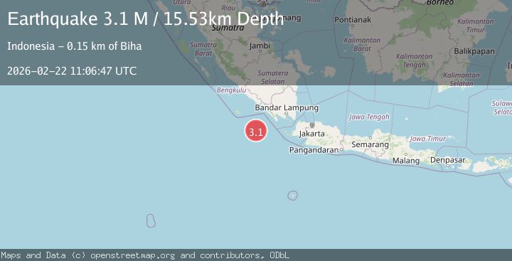
Earthquake Southwest of Sumatra, Indonesia
Sun, 22 Feb 2026 11:06:46 GMT
Time1 hour ago
Location
-6.4243, 103.1942
Depth
22.6 KM
Event Summary
A 3.0 magnitude earthquake struck on Southwest of Sumatra, Indonesia, at Sun, 22 Feb 2026 11:06:46 GMT. Depth: 22.600389km. Reviewed by BMKG seismologists, this minor quake occurred at a magnitude type of M.
Magnitude
3.0
M
Source
BMKG
Intensity
-
Agency Reports
1 Sources| Source | Magnitude | Depth | Time |
|---|---|---|---|
| BMKGPrimary | 3.0 | 23 km | 1 hour ago |
Earthquake Details
ManualEvent IDbmg2026drwe
Tsunami PotentialNo
Magnitude TypeM
Nearest Places
- 77.5 km
- 137.3 km
- 137.7 km
- 139.2 km
- 139.2 km
Comments
Join the discussion about this event.
Latest Earthquakes
2.1Mag
near the coast of Antofagasta, Chile
Time1 hour ago
Depth0.00 km
SourceVYT (Automatic)
2.1Mag
WESTERN TURKEY
Time1 hour ago
Depth7.00 km
SourceAFAD (Automatic)
1.9Mag
Arizona
Time1 hour ago
Depth6.47 km
SourceVYT (Automatic)
2.2Mag
14 km NW of Beaverdam, Nevada
Time1 hour ago
Depth15.99 km
SourceUSGS (Automatic)
2.5Mag
UTAH
Time1 hour ago
Depth8.20 km
SourceNEIC (Automatic)
Nearby Earthquakes
3.0Mag
SOUTHWEST OF SUMATRA, INDONESIA
Time4 years ago
Depth13.00 km
SourceDJA (Automatic)
4.0Mag
SOUTHWEST OF SUMATRA, INDONESIA
Time3 years ago
Depth10.00 km
SourceDJA (Automatic)
3.0Mag
SOUTHWEST OF SUMATRA, INDONESIA
Time3 years ago
Depth10.00 km
SourceDJA (Automatic)
4.0Mag
SOUTHWEST OF SUMATRA, INDONESIA
Time6 years ago
Depth10.00 km
SourceDJA (Automatic)
3.1Mag
SOUTHWEST OF SUMATRA, INDONESIA
Time1 week ago
Depth15.00 km
SourceBMKG (Automatic)