Earthquake Southern Sumatra, Indonesia
Sun, 22 Feb 2026 14:43:53 GMT
Time1 hour ago
Location
-2.0757, 100.5447
Depth
27.7 KM
Event Summary
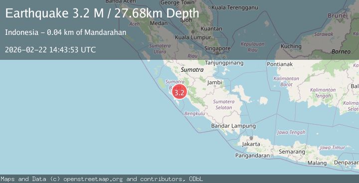
A 3.2 magnitude earthquake struck on Southern Sumatra, Indonesia, at Sun, 22 Feb 2026 14:43:53 GMT. Depth: 27.680557km. Reviewed by BMKG seismologists, this minor quake occurred at a magnitude type of M.
Magnitude
3.2
M
Source
BMKG
Intensity
-
Agency Reports
1 Sources| Source | Magnitude | Depth | Time |
|---|---|---|---|
| BMKGPrimary | 3.2 | 28 km | 1 hour ago |
Earthquake Details
ManualEvent IDbmg2026dsdi
Tsunami PotentialNo
Magnitude TypeM
Nearest Places
- 21.3 km
- 21.5 km
- 31.2 km
- 31.3 km
- 34.3 km
Comments
Join the discussion about this event.
Latest Earthquakes
2.1Mag
Flores Region, Indonesia
Time1 hour ago
Depth1.67 km
SourceBMKG
2.6Mag
NICARAGUA
Time1 hour ago
Depth70.00 km
SourceINET (Automatic)
1.3Mag
Southern Alaska
Time1 hour ago
Depth13.06 km
SourceVYT (Automatic)
1.3Mag
WESTERN TURKEY
Time1 hour ago
Depth7.00 km
SourceAFAD (Automatic)
1.6Mag
STRAIT OF GIBRALTAR
Time1 hour ago
Depth13.20 km
SourceIGN (Automatic)
Nearby Earthquakes
3.0Mag
KEP. MENTAWAI REGION, INDONESIA
Time2 months ago
Depth13.00 km
SourceBMKG (Automatic)
3.0Mag
KEP. MENTAWAI REGION, INDONESIA
Time2 months ago
Depth21.00 km
SourceBMKG (Automatic)
2.9Mag
Southern Sumatra, Indonesia
Time3 weeks ago
Depth11.52 km
SourceBMKG (Automatic)
5.0Mag
KEP. MENTAWAI REGION, INDONESIA
Time1 year ago
Depth57.00 km
SourceEMSC (Automatic)
3.5Mag
Southern Sumatra, Indonesia
Time3 weeks ago
Depth46.40 km
SourceBMKG (Automatic)