Earthquake Timor Region
Mon, 23 Feb 2026 12:39:22 GMT
Time1 hour ago
Location
-8.7261, 124.1753
Depth
80.3 KM
Event Summary
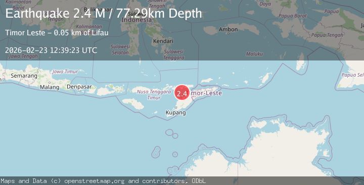
A 2.2 magnitude earthquake struck on Timor Region, at Mon, 23 Feb 2026 12:39:22 GMT. Depth: 80.261719km. Reviewed by BMKG seismologists, this minor quake occurred at a magnitude type of M.
Magnitude
2.2
M
Source
BMKG
Intensity
-
Agency Reports
1 Sources| Source | Magnitude | Depth | Time |
|---|---|---|---|
| BMKGPrimary | 2.2 | 80 km | 1 hour ago |
Earthquake Details
ManualEvent IDbmg2026dtus
Tsunami PotentialNo
Magnitude TypeM
Nearest Places
- 21.3 km
- 21.6 km
- 23.1 km
- 23.6 km
- 23.9 km
Comments
Join the discussion about this event.
Latest Earthquakes
1.6Mag
Southern Alaska
Time1 hour ago
Depth11.47 km
SourceVYT (Automatic)
2.9Mag
Savu Sea
Time1 hour ago
Depth53.21 km
SourceBMKG
2.9Mag
Fox Islands, Aleutian Islands, Alaska
Time1 hour ago
Depth0.00 km
SourceVYT (Automatic)
2.5Mag
Gulf of Alaska
Time1 hour ago
Depth348.88 km
SourceVYT (Automatic)
2.7Mag
WESTERN TURKEY
Time1 hour ago
Depth19.60 km
SourceKOERI (Automatic)
Nearby Earthquakes
3.0Mag
KEPULAUAN ALOR, INDONESIA
Time5 years ago
Depth32.00 km
SourceDJA (Automatic)
2.6Mag
Timor Region
Time1 week ago
Depth85.93 km
SourceBMKG
3.0Mag
KEPULAUAN ALOR, INDONESIA
Time4 years ago
Depth83.00 km
SourceDJA (Automatic)
2.5Mag
KEPULAUAN ALOR, INDONESIA
Time1 month ago
Depth86.00 km
SourceBMKG (Automatic)
3.0Mag
KEPULAUAN ALOR, INDONESIA
Time1 year ago
Depth64.00 km
SourceBMKG (Automatic)