Earthquake Northern Sumatra, Indonesia
Mon, 23 Feb 2026 13:48:34 GMT
Time1 hour ago
Location
4.7326, 96.7866
Depth
12.1 KM
Event Summary
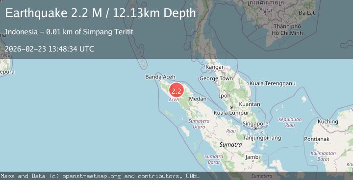
A 2.2 magnitude earthquake struck on Northern Sumatra, Indonesia, at Mon, 23 Feb 2026 13:48:34 GMT. Depth: 12.126536km. Reviewed by BMKG seismologists, this minor quake occurred at a magnitude type of M.
Magnitude
2.2
M
Source
BMKG
Intensity
-
Agency Reports
1 Sources| Source | Magnitude | Depth | Time |
|---|---|---|---|
| BMKGPrimary | 2.2 | 12 km | 1 hour ago |
Earthquake Details
ManualEvent IDbmg2026dtwz
Tsunami PotentialNo
Magnitude TypeM
Nearest Places
- 0.5 km
- 0.6 km
- 0.7 km
- 0.7 km
- 0.8 km
Comments
Join the discussion about this event.
Latest Earthquakes
2.4Mag
Sumba Region, Indonesia
Time1 hour ago
Depth10.77 km
SourceBMKG
2.1Mag
WESTERN TEXAS
Time1 hour ago
Depth4.20 km
SourceTX (Automatic)
1.2Mag
12 km ENE of Borrego Springs, CA
Time1 hour ago
Depth13.21 km
SourceUSGS (Automatic)
0.7Mag
7 km NW of The Geysers, CA
Time1 hour ago
Depth2.97 km
SourceUSGS (Automatic)
1.5Mag
Kenai Peninsula, Alaska
Time1 hour ago
Depth126.95 km
SourceVYT (Automatic)
Nearby Earthquakes
2.5Mag
Northern Sumatra, Indonesia
Time6 days ago
Depth10.00 km
SourceBMKG
3.0Mag
NORTHERN SUMATRA, INDONESIA
Time1 month ago
Depth10.00 km
SourceBMKG (Automatic)
3.0Mag
NORTHERN SUMATRA, INDONESIA
Time1 month ago
Depth5.00 km
SourceBMKG (Automatic)
3.0Mag
NORTHERN SUMATRA, INDONESIA
Time2 months ago
Depth10.00 km
SourceBMKG (Automatic)
2.6Mag
NORTHERN SUMATRA, INDONESIA
Time1 month ago
Depth6.00 km
SourceBMKG (Automatic)