Earthquake Near North Coast of West Papua
Mon, 23 Feb 2026 22:28:33 GMT
Time1 hour ago
Location
-2.3715, 140.1616
Depth
22.0 KM
Event Summary
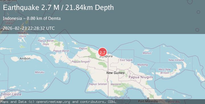
A 2.7 magnitude earthquake struck on Near North Coast of West Papua, at Mon, 23 Feb 2026 22:28:33 GMT. Depth: 22.014574km. Reviewed by BMKG seismologists, this minor quake occurred at a magnitude type of M.
Magnitude
2.7
M
Source
BMKG
Intensity
-
Agency Reports
1 Sources| Source | Magnitude | Depth | Time |
|---|---|---|---|
| BMKGPrimary | 2.7 | 22 km | 1 hour ago |
Earthquake Details
ManualEvent IDbmg2026duod
Tsunami PotentialNo
Magnitude TypeM
Nearest Places
- 0.5 km
- 0.7 km
- 1.4 km
- 1.9 km
- 2.0 km
Comments
Join the discussion about this event.
Latest Earthquakes
1.4Mag
Tarapaca, Chile
Time1 hour ago
Depth35.28 km
SourceVYT (Automatic)
2.6Mag
New Mexico
Time1 hour ago
Depth4.15 km
SourceVYT (Automatic)
3.4Mag
Northern Molucca Sea
Time1 hour ago
Depth1.75 km
SourceBMKG
3.3Mag
Molucca Sea
Time1 hour ago
Depth0.00 km
SourceVYT (Automatic)
1.4Mag
Tarapaca, Chile
Time1 hour ago
Depth100.95 km
SourceVYT (Automatic)
Nearby Earthquakes
2.4Mag
Near North Coast of West Papua
Time2 weeks ago
Depth10.00 km
SourceBMKG (Automatic)
3.0Mag
NEAR N COAST OF PAPUA, INDONESIA
Time2 years ago
Depth14.00 km
SourceBMKG (Automatic)
5.2Mag
NEAR N COAST OF PAPUA, INDONESIA
Time7 years ago
Depth10.00 km
SourceEMSC (Automatic)
3.0Mag
NEAR N COAST OF PAPUA, INDONESIA
Time6 years ago
Depth24.00 km
SourceDJA (Automatic)
5.0Mag
NEAR N COAST OF PAPUA, INDONESIA
Time3 years ago
Depth40.00 km
SourceEMSC (Automatic)