Earthquake Near North Coast of West Papua
Sun, 08 Feb 2026 17:56:18 GMT
Time4 hours ago
Location
-2.3478, 140.1530
Depth
10.0 KM
Event Summary
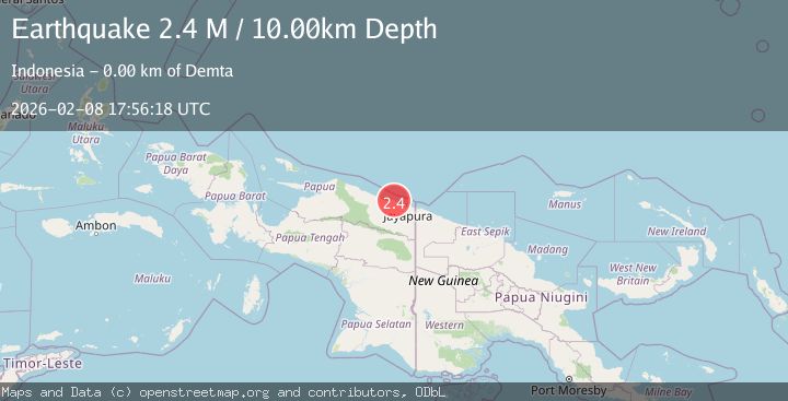
A 2.4 magnitude earthquake struck on Near North Coast of West Papua, at Sun, 08 Feb 2026 17:56:18 GMT. Depth: 10km. Reviewed by BMKG seismologists, this minor quake occurred at a magnitude type of M.
Magnitude
2.4
M
Source
BMKG
Intensity
-
Agency Reports
1 Sources| Source | Magnitude | Depth | Time |
|---|---|---|---|
| BMKGPrimary | 2.4 | 10 km | 4 hours ago |
Earthquake Details
AutomaticEvent IDbmg2026csuq
Tsunami PotentialNo
Magnitude TypeM
Nearest Places
- Teluk Demta0.7 km
- Tanjung Ande0.8 km
- Kampung Yougapsa1.1 km
- Demta1.4 km
- Muris Kecil1.5 km
Comments
Join the discussion about this event.
Latest Earthquakes
1.9Mag
10 km SSW of Valencia, CA
Time4 hours ago
Depth9.69 km
SourceUSGS (Automatic)
3.3Mag
OFFSHORE COQUIMBO, CHILE
Time4 hours ago
Depth44.20 km
SourceCSN (Automatic)
2.6Mag
West Papua Region, Indonesia
Time4 hours ago
Depth10.00 km
SourceBMKG (Automatic)
2.8Mag
ANTOFAGASTA, CHILE
Time4 hours ago
Depth134.60 km
SourceCSN (Automatic)
2.9Mag
Sumbawa Region, Indonesia
Time4 hours ago
Depth12.85 km
SourceBMKG (Automatic)
Nearby Earthquakes
2.4Mag
Near North Coast of West Papua
Time2 weeks ago
Depth18.12 km
SourceBMKG (Automatic)
3.2Mag
Near North Coast of West Papua
Time1 week ago
Depth10.00 km
SourceBMKG (Automatic)
2.2Mag
Near North Coast of West Papua
Time1 week ago
Depth4.12 km
SourceBMKG (Automatic)
2.6Mag
Near North Coast of West Papua
Time1 week ago
Depth18.57 km
SourceBMKG (Automatic)
2.2Mag
Near North Coast of West Papua
Time2 days ago
Depth10.00 km
SourceBMKG (Automatic)