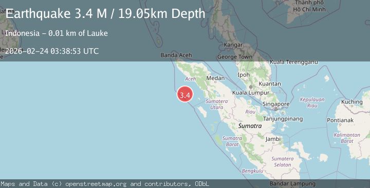
Earthquake Northern Sumatra, Indonesia
Tue, 24 Feb 2026 03:38:51 GMT
Time1 hour ago
Location
2.5431, 96.0957
Depth
1.0 KM
Event Summary
A 2.1 magnitude earthquake struck on Northern Sumatra, Indonesia, at Tue, 24 Feb 2026 03:38:51 GMT. Depth: 1.025802km. Reviewed by BMKG seismologists, this minor quake occurred at a magnitude type of M.
Magnitude
2.1
M
Source
BMKG
Intensity
-
Agency Reports
1 Sources| Source | Magnitude | Depth | Time |
|---|---|---|---|
| BMKGPrimary | 2.1 | 1 km | 1 hour ago |
Earthquake Details
ManualEvent IDbmg2026duyk
Tsunami PotentialNo
Magnitude TypeM
Nearest Places
- 1.6 km
- 2.1 km
- 2.9 km
- 3.3 km
- 3.5 km
Comments
Join the discussion about this event.
Latest Earthquakes
1.3Mag
Southern Alaska
Time1 hour ago
Depth11.23 km
SourceVYT (Automatic)
1.5Mag
Tarapaca, Chile
Time1 hour ago
Depth0.00 km
SourceVYT (Automatic)
2.1Mag
Fox Islands, Aleutian Islands, Alaska
Time1 hour ago
Depth0.00 km
SourceVYT (Automatic)
2.2Mag
Central Alaska
Time1 hour ago
Depth3.91 km
SourceVYT (Automatic)
0.6Mag
8 km SW of Anza, CA
Time1 hour ago
Depth3.50 km
SourceUSGS (Automatic)
Nearby Earthquakes
4.0Mag
SIMEULUE, INDONESIA
Time2 months ago
Depth10.00 km
SourceBMKG (Automatic)
4.0Mag
SIMEULUE, INDONESIA
Time1 month ago
Depth1.00 km
SourceBMKG (Automatic)
5.2Mag
SIMEULUE, INDONESIA
Time2 months ago
Depth12.10 km
SourceEMSC (Automatic)
5.0Mag
SIMEULUE, INDONESIA
Time17 years ago
Depth10.00 km
SourceEMSC (Automatic)
3.8Mag
SIMEULUE, INDONESIA
Time1 month ago
Depth5.00 km
SourceBMKG (Automatic)