Earthquake Near North Coast of West Papua
Fri, 27 Feb 2026 18:51:51 GMT
Time1 hour ago
Location
-2.2527, 140.2856
Depth
10.0 KM
Event Summary
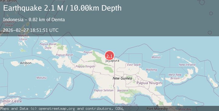
A 2.1 magnitude earthquake struck on Near North Coast of West Papua, at Fri, 27 Feb 2026 18:51:51 GMT. Depth: 10km. Reviewed by BMKG seismologists, this minor quake occurred at a magnitude type of M.
Magnitude
2.1
M
Source
BMKG
Intensity
-
Agency Reports
1 Sources| Source | Magnitude | Depth | Time |
|---|---|---|---|
| BMKGPrimary | 2.1 | 10 km | 1 hour ago |
Earthquake Details
ManualEvent IDbmg2026ebpa
Tsunami PotentialNo
Magnitude TypeM
Nearest Places
- 14.4 km
- 16.9 km
- 17.1 km
- 17.3 km
- 17.5 km
Comments
Join the discussion about this event.
Latest Earthquakes
2.0Mag
Southeastern Alaska
Time1 hour ago
Depth0.00 km
SourceVYT (Automatic)
1.3Mag
15 km NNW of Sand Springs, Texas
Time1 hour ago
Depth3.18 km
SourceUSGS (Automatic)
2.4Mag
OKLAHOMA
Time1 hour ago
Depth5.80 km
SourceOK (Automatic)
1.9Mag
Southern Alaska
Time1 hour ago
Depth4.15 km
SourceVYT (Automatic)
0.7Mag
9 km WNW of The Geysers, CA
Time1 hour ago
Depth2.09 km
SourceUSGS (Automatic)
Nearby Earthquakes
5.3Mag
NEAR N COAST OF PAPUA, INDONESIA
Time9 years ago
Depth10.00 km
SourceEMSC (Automatic)
4.0Mag
near the north coast of Papua, Indonesia
Time2 weeks ago
Depth0.00 km
SourceVYT (Automatic)
4.0Mag
NEAR N COAST OF PAPUA, INDONESIA
Time1 year ago
Depth10.00 km
SourceBMKG (Automatic)
2.8Mag
NEAR N COAST OF PAPUA, INDONESIA
Time2 months ago
Depth5.00 km
SourceBMKG (Automatic)
3.0Mag
NEAR N COAST OF PAPUA, INDONESIA
Time4 years ago
Depth11.00 km
SourceDJA (Automatic)