Earthquake West Papua Region, Indonesia
Sat, 28 Feb 2026 13:35:53 GMT
Time1 hour ago
Location
-0.6791, 135.7287
Depth
9.7 KM
Event Summary
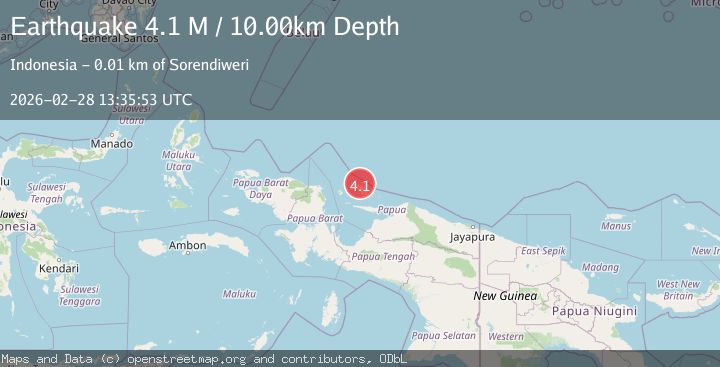
A 3.9 magnitude earthquake struck on West Papua Region, Indonesia, at Sat, 28 Feb 2026 13:35:53 GMT. Depth: 9.656292km. Reviewed by BMKG seismologists, this minor quake occurred at a magnitude type of M.
Magnitude
3.9
M
Source
BMKG
Intensity
-
Agency Reports
1 Sources| Source | Magnitude | Depth | Time |
|---|---|---|---|
| BMKGPrimary | 3.9 | 10 km | 1 hour ago |
Earthquake Details
ManualEvent IDbmg2026edac
Tsunami PotentialNo
Magnitude TypeM
Nearest Places
- 3.3 km
- 4.6 km
- 4.7 km
- 5.5 km
- 5.8 km
Comments
Join the discussion about this event.
Latest Earthquakes
1.1Mag
Southeastern Alaska
Time1 hour ago
Depth11.11 km
SourceVYT (Automatic)
1.6Mag
4 km W of Lake Henshaw, CA
Time1 hour ago
Depth9.95 km
SourceUSGS (Automatic)
1.6Mag
Southern Alaska
Time1 hour ago
Depth66.89 km
SourceVYT (Automatic)
3.8Mag
Jujuy, Argentina
Time1 hour ago
Depth317.38 km
SourceVYT (Automatic)
2.7Mag
Flores Sea
Time1 hour ago
Depth22.93 km
SourceBMKG
Nearby Earthquakes
2.7Mag
BIAK REGION, INDONESIA
Time2 weeks ago
Depth10.00 km
SourceBMKG (Automatic)
4.0Mag
BIAK REGION, INDONESIA
Time2 years ago
Depth18.00 km
SourceBMKG (Automatic)
5.3Mag
BIAK REGION, INDONESIA
Time2 years ago
Depth10.00 km
SourceEMSC (Automatic)
2.5Mag
BIAK REGION, INDONESIA
Time1 month ago
Depth10.00 km
SourceBMKG (Automatic)
3.0Mag
West Papua Region, Indonesia
Time1 month ago
Depth10.00 km
SourceBMKG (Automatic)