Earthquake 4 km W of Lake Henshaw, CA
Sat, 28 Feb 2026 13:36:31 GMT
Time1 hour ago
Location
33.2383, -116.8073
Depth
9.9 KM
Event Summary
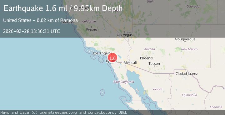
A 1.6 magnitude earthquake struck on 4 km W of Lake Henshaw, CA, at Sat, 28 Feb 2026 13:36:31 GMT. Depth: 9.94999980926514km. Reviewed by USGS seismologists, this minor quake occurred at a magnitude type of ml.
Magnitude
1.6
ml
Source
USGS
Intensity
-
Agency Reports
1 Sources| Source | Magnitude | Depth | Time |
|---|---|---|---|
| USGSPrimary | 1.6 | 10 km | 1 hour ago |
Earthquake Details
AutomaticEvent IDusgs_ci41406344
Tsunami PotentialNo
Magnitude Typeml
Nearest Places
- 1.6 km
- 2.1 km
- 2.2 km
- 2.3 km
- 2.6 km
Comments
Join the discussion about this event.
Latest Earthquakes
1.1Mag
Southeastern Alaska
Time1 hour ago
Depth11.11 km
SourceVYT (Automatic)
3.9Mag
West Papua Region, Indonesia
Time1 hour ago
Depth9.66 km
SourceBMKG
1.6Mag
Southern Alaska
Time1 hour ago
Depth66.89 km
SourceVYT (Automatic)
3.8Mag
Jujuy, Argentina
Time1 hour ago
Depth317.38 km
SourceVYT (Automatic)
2.7Mag
Flores Sea
Time1 hour ago
Depth22.93 km
SourceBMKG
Nearby Earthquakes
0.6Mag
4 km W of Lake Henshaw, CA
Time6 days ago
Depth12.17 km
SourceUSGS (Automatic)
1.3Mag
4 km W of Lake Henshaw, CA
Time1 week ago
Depth11.95 km
SourceUSGS (Automatic)
0.7Mag
4 km W of Lake Henshaw, CA
Time1 week ago
Depth11.64 km
SourceUSGS (Automatic)
1.3Mag
4 km W of Lake Henshaw, CA
Time2 hours ago
Depth10.59 km
SourceUSGS (Automatic)
0.6Mag
4 km W of Lake Henshaw, CA
Time1 week ago
Depth12.09 km
SourceUSGS (Automatic)