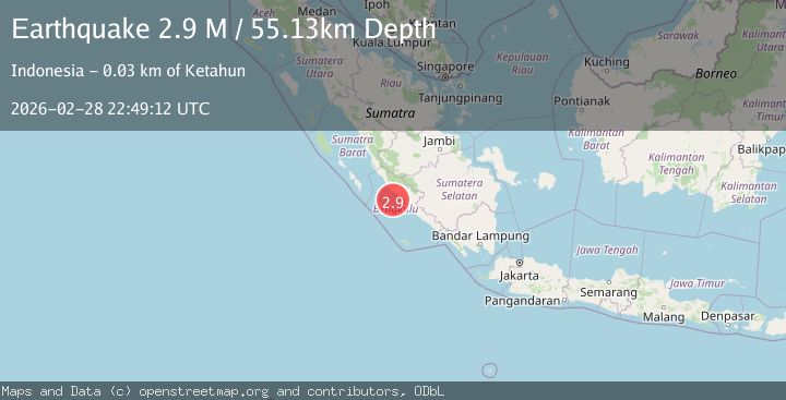
Earthquake Southern Sumatra, Indonesia
Sat, 28 Feb 2026 22:49:12 GMT
Time4 hours ago
Location
-3.5711, 101.8338
Depth
63.3 KM
Event Summary
A 2.8 magnitude earthquake struck on Southern Sumatra, Indonesia, at Sat, 28 Feb 2026 22:49:12 GMT. Depth: 63.295578km. Reviewed by BMKG seismologists, this minor quake occurred at a magnitude type of M.
Magnitude
2.8
M
Source
BMKG
Intensity
-
Agency Reports
1 Sources| Source | Magnitude | Depth | Time |
|---|---|---|---|
| BMKGPrimary | 2.8 | 63 km | 4 hours ago |
Earthquake Details
ManualEvent IDbmg2026edsi
Tsunami PotentialNo
Magnitude TypeM
Nearest Places
- 16.8 km
- 16.8 km
- 16.8 km
- 17.1 km
- 17.2 km
Comments
Join the discussion about this event.
Latest Earthquakes
3.9Mag
Java, Indonesia
Time4 hours ago
Depth29.79 km
SourceVYT (Automatic)
2.5Mag
NEVADA
Time4 hours ago
Depth4.30 km
SourceNN (Automatic)
0.8Mag
26 km SE of Minto, Alaska
Time4 hours ago
Depth30.00 km
SourceUSGS (Automatic)
0.4Mag
6 km NNW of The Geysers, CA
Time4 hours ago
Depth1.31 km
SourceUSGS (Automatic)
2.5Mag
ANTOFAGASTA, CHILE
Time4 hours ago
Depth114.30 km
SourceCSN (Automatic)
Nearby Earthquakes
3.0Mag
SOUTHERN SUMATRA, INDONESIA
Time4 years ago
Depth26.00 km
SourceDJA (Automatic)
5.7Mag
SOUTHERN SUMATRA, INDONESIA
Time18 years ago
Depth40.00 km
SourceEMSC (Automatic)
3.0Mag
SOUTHERN SUMATRA, INDONESIA
Time3 years ago
Depth28.00 km
SourceDJA (Automatic)
3.2Mag
Southern Sumatra, Indonesia
Time3 weeks ago
Depth25.26 km
SourceBMKG (Automatic)
6.4Mag
SOUTHERN SUMATRA, INDONESIA
Time8 years ago
Depth53.00 km
SourceEMSC (Automatic)