Earthquake Northern Sumatra, Indonesia
Sun, 01 Mar 2026 12:31:58 GMT
Time7 hours ago
Location
1.6709, 99.1799
Depth
2.6 KM
Event Summary
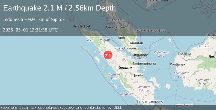
A 2.1 magnitude earthquake struck on Northern Sumatra, Indonesia, at Sun, 01 Mar 2026 12:31:58 GMT. Depth: 2.564725km. Reviewed by BMKG seismologists, this minor quake occurred at a magnitude type of M.
Magnitude
2.1
M
Source
BMKG
Intensity
-
Agency Reports
1 Sources| Source | Magnitude | Depth | Time |
|---|---|---|---|
| BMKGPrimary | 2.1 | 3 km | 7 hours ago |
Earthquake Details
ManualEvent IDbmg2026eetm
Tsunami PotentialNo
Magnitude TypeM
Nearest Places
- 0.5 km
- 0.9 km
- 1.4 km
- 1.9 km
- 1.9 km
Comments
Join the discussion about this event.
Latest Earthquakes
0.9Mag
Southern Alaska
Time7 hours ago
Depth0.00 km
SourceVYT (Automatic)
1.3Mag
6 km E of Yucaipa, CA
Time7 hours ago
Depth20.42 km
SourceUSGS (Automatic)
3.1Mag
Antofagasta, Chile
Time7 hours ago
Depth71.53 km
SourceVYT (Automatic)
1.6Mag
53 km E of Tonopah, Nevada
Time7 hours ago
Depth6.37 km
SourceUSGS (Automatic)
1.4Mag
15 km W of Johannesburg, CA
Time7 hours ago
Depth4.30 km
SourceUSGS (Automatic)
Nearby Earthquakes
2.2Mag
Northern Sumatra, Indonesia
Time15 hours ago
Depth7.34 km
SourceBMKG
3.0Mag
NORTHERN SUMATRA, INDONESIA
Time6 years ago
Depth10.00 km
SourceDJA (Automatic)
3.0Mag
NORTHERN SUMATRA, INDONESIA
Time4 years ago
Depth10.00 km
SourceDJA (Automatic)
3.0Mag
NORTHERN SUMATRA, INDONESIA
Time11 months ago
Depth10.00 km
SourceBMKG (Automatic)
3.0Mag
NORTHERN SUMATRA, INDONESIA
Time5 years ago
Depth10.00 km
SourceDJA (Automatic)