Earthquake Near North Coast of West Papua
Mon, 02 Mar 2026 14:13:31 GMT
Time2 hours ago
Location
-1.2038, 137.7857
Depth
10.0 KM
Event Summary
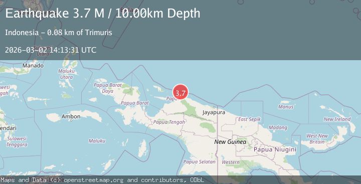
A 3.7 magnitude earthquake struck on Near North Coast of West Papua, at Mon, 02 Mar 2026 14:13:31 GMT. Depth: 10km. Reviewed by BMKG seismologists, this minor quake occurred at a magnitude type of M.
Magnitude
3.7
M
Source
BMKG
Intensity
-
Agency Reports
1 Sources| Source | Magnitude | Depth | Time |
|---|---|---|---|
| BMKGPrimary | 3.7 | 10 km | 2 hours ago |
Earthquake Details
ManualEvent IDbmg2026egsi
Tsunami PotentialNo
Magnitude TypeM
Nearest Places
- 27.5 km
- 31.1 km
- 31.6 km
- 32.8 km
- 32.8 km
Comments
Join the discussion about this event.
Latest Earthquakes
3.6Mag
Rat Islands, Aleutian Islands, Alaska
Time1 hour ago
Depth164.18 km
SourceVYT (Automatic)
1.0Mag
34 km NNW of Chickaloon, Alaska
Time1 hour ago
Depth31.30 km
SourceUSGS (Automatic)
1.3Mag
5 km WNW of Cobb, CA
Time1 hour ago
Depth2.06 km
SourceUSGS (Automatic)
2.3Mag
Near North Coast of West Papua
Time2 hours ago
Depth13.56 km
SourceBMKG
3.0Mag
southern Sumatra, Indonesia
Time2 hours ago
Depth148.56 km
SourceVYT (Automatic)
Nearby Earthquakes
5.0Mag
NEAR N COAST OF PAPUA, INDONESIA
Time14 years ago
Depth49.00 km
SourceEMSC (Automatic)
3.6Mag
NEAR N COAST OF PAPUA, INDONESIA
Time2 months ago
Depth10.00 km
SourceBMKG (Automatic)
5.5Mag
NEAR N COAST OF PAPUA, INDONESIA
Time7 years ago
Depth10.00 km
SourceEMSC (Automatic)
3.7Mag
Near North Coast of West Papua
Time2 weeks ago
Depth13.18 km
SourceBMKG (Automatic)
5.1Mag
NEAR N COAST OF PAPUA, INDONESIA
Time14 years ago
Depth10.00 km
SourceEMSC (Automatic)