Earthquake Near North Coast of West Papua
Mon, 09 Feb 2026 20:19:47 GMT
Time1 hour ago
Location
-1.7302, 137.4729
Depth
13.2 KM
Event Summary
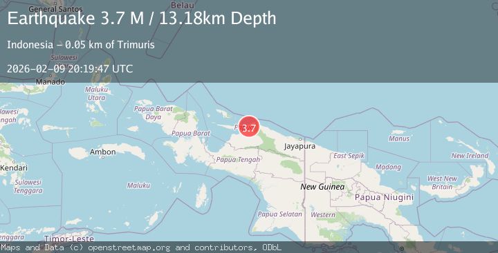
A 3.7 magnitude earthquake struck on Near North Coast of West Papua, at Mon, 09 Feb 2026 20:19:47 GMT. Depth: 13.18323km. Reviewed by BMKG seismologists, this minor quake occurred at a magnitude type of M.
Magnitude
3.7
M
Source
BMKG
Intensity
-
Agency Reports
1 Sources| Source | Magnitude | Depth | Time |
|---|---|---|---|
| BMKGPrimary | 3.7 | 13 km | 1 hour ago |
Earthquake Details
AutomaticEvent IDbmg2026cuuw
Tsunami PotentialNo
Magnitude TypeM
Nearest Places
- Distrik Sawai10.1 km
- Poi10.7 km
- Wair11.3 km
- Kampung Anasi13.0 km
- Kampung Tamakuri13.6 km
Comments
Join the discussion about this event.
Latest Earthquakes
2.1Mag
NORTHERN CALIFORNIA
Time1 hour ago
Depth3.60 km
SourceNC (Automatic)
2.7Mag
OFFSHORE VALPARAISO, CHILE
Time1 hour ago
Depth34.20 km
SourceCSN (Automatic)
2.2Mag
WESTERN TURKEY
Time1 hour ago
Depth6.20 km
SourceKOERI (Automatic)
3.1Mag
NEAR COAST OF NICARAGUA
Time1 hour ago
Depth8.00 km
SourceINET (Automatic)
3.9Mag
MYANMAR
Time1 hour ago
Depth11.00 km
SourceTSB (Automatic)
Nearby Earthquakes
4.7Mag
West Papua, Indonesia
Time1 week ago
Depth81.32 km
SourceBMKG (Automatic)
3.0Mag
West Papua Region, Indonesia
Time3 days ago
Depth15.50 km
SourceBMKG (Automatic)
3.5Mag
West Papua Region, Indonesia
Time11 hours ago
Depth8.52 km
SourceBMKG (Automatic)
4.3Mag
West Papua, Indonesia
Time2 weeks ago
Depth79.49 km
SourceBMKG (Automatic)
2.8Mag
West Papua Region, Indonesia
Time1 week ago
Depth19.31 km
SourceBMKG (Automatic)