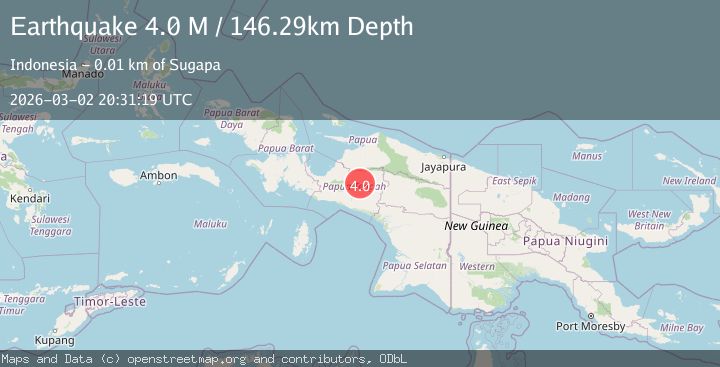
Earthquake West Papua Region, Indonesia
Mon, 02 Mar 2026 20:31:20 GMT
Time3 hours ago
Location
-4.0747, 136.4775
Depth
190.3 KM
Event Summary
A 4.0 magnitude earthquake struck on West Papua Region, Indonesia, at Mon, 02 Mar 2026 20:31:20 GMT. Depth: 190.252533km. Reviewed by BMKG seismologists, this minor quake occurred at a magnitude type of M.
Magnitude
4.0
M
Source
BMKG
Intensity
-
Agency Reports
1 Sources| Source | Magnitude | Depth | Time |
|---|---|---|---|
| BMKGPrimary | 4.0 | 190 km | 3 hours ago |
Earthquake Details
ManualEvent IDbmg2026eheu
Tsunami PotentialNo
Magnitude TypeM
Nearest Places
- 5.9 km
- 8.1 km
- 9.3 km
- 10.2 km
- 10.2 km
Comments
Join the discussion about this event.
Latest Earthquakes
2.5Mag
Antofagasta, Chile
Time3 hours ago
Depth0.00 km
SourceVYT (Automatic)
2.1Mag
Flores Region, Indonesia
Time3 hours ago
Depth18.89 km
SourceBMKG
2.0Mag
Java, Indonesia
Time3 hours ago
Depth39.61 km
SourceBMKG
2.5Mag
FLORES REGION, INDONESIA
Time3 hours ago
Depth117.00 km
SourceBMKG (Automatic)
0.4Mag
10 km WNW of The Geysers, CA
Time3 hours ago
Depth1.92 km
SourceUSGS (Automatic)
Nearby Earthquakes
4.0Mag
NEAR S COAST OF PAPUA, INDONESIA
Time4 years ago
Depth10.00 km
SourceDJA (Automatic)
2.9Mag
PAPUA, INDONESIA
Time1 month ago
Depth10.00 km
SourceBMKG (Automatic)
3.2Mag
PAPUA, INDONESIA
Time1 month ago
Depth10.00 km
SourceBMKG (Automatic)
5.0Mag
PAPUA, INDONESIA
Time19 years ago
Depth33.00 km
SourceEMSC (Automatic)
4.0Mag
PAPUA, INDONESIA
Time1 year ago
Depth12.00 km
SourceBMKG (Automatic)