Earthquake Northern Sumatra, Indonesia
Tue, 03 Mar 2026 06:06:22 GMT
Time2 hours ago
Location
2.0703, 96.6207
Depth
2.6 KM
Event Summary
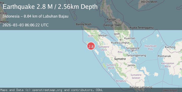
A 2.8 magnitude earthquake struck on Northern Sumatra, Indonesia, at Tue, 03 Mar 2026 06:06:22 GMT. Depth: 2.560928km. Reviewed by BMKG seismologists, this minor quake occurred at a magnitude type of M.
Magnitude
2.8
M
Source
BMKG
Intensity
-
Agency Reports
1 Sources| Source | Magnitude | Depth | Time |
|---|---|---|---|
| BMKGPrimary | 2.8 | 3 km | 2 hours ago |
Earthquake Details
ManualEvent IDbmg2026ehxu
Tsunami PotentialNo
Magnitude TypeM
Nearest Places
- 3.7 km
- 3.9 km
- 11.0 km
- 12.7 km
- 15.6 km
Comments
Join the discussion about this event.
Latest Earthquakes
0.9Mag
7 km NW of The Geysers, CA
Time2 hours ago
Depth2.91 km
SourceUSGS (Automatic)
0.4Mag
4 km WNW of Lake Henshaw, CA
Time2 hours ago
Depth12.62 km
SourceUSGS (Automatic)
3.9Mag
off the west coast of northern Sumatra
Time2 hours ago
Depth10.00 km
SourceVYT (Automatic)
2.0Mag
Olympic Peninsula, Washington
Time2 hours ago
Depth0.00 km
SourceVYT (Automatic)
2.9Mag
western Texas
Time2 hours ago
Depth0.00 km
SourceVYT (Automatic)
Nearby Earthquakes
5.1Mag
SIMEULUE, INDONESIA
Time14 years ago
Depth30.00 km
SourceEMSC (Automatic)
5.1Mag
SIMEULUE, INDONESIA
Time18 years ago
Depth40.00 km
SourceEMSC (Automatic)
3.0Mag
SIMEULUE, INDONESIA
Time9 months ago
Depth11.00 km
SourceBMKG (Automatic)
2.5Mag
Northern Sumatra, Indonesia
Time1 week ago
Depth5.00 km
SourceBMKG
5.3Mag
SIMEULUE, INDONESIA
Time14 years ago
Depth30.00 km
SourceEMSC (Automatic)