Earthquake South of Bali, Indonesia
Tue, 03 Mar 2026 11:05:57 GMT
Time1 hour ago
Location
-9.1286, 114.8479
Depth
53.8 KM
Event Summary
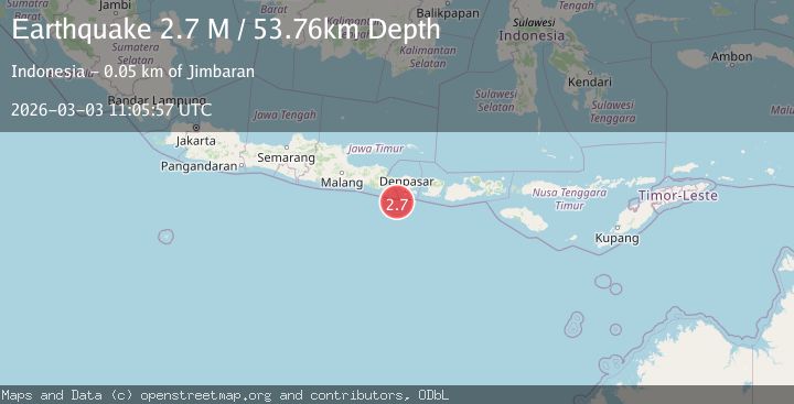
A 2.7 magnitude earthquake struck on South of Bali, Indonesia, at Tue, 03 Mar 2026 11:05:57 GMT. Depth: 53.761143km. Reviewed by BMKG seismologists, this minor quake occurred at a magnitude type of M.
Magnitude
2.7
M
Source
BMKG
Intensity
-
Agency Reports
1 Sources| Source | Magnitude | Depth | Time |
|---|---|---|---|
| BMKGPrimary | 2.7 | 54 km | 1 hour ago |
Earthquake Details
ManualEvent IDbmg2026eihr
Tsunami PotentialNo
Magnitude TypeM
Nearest Places
- 41.8 km
- 42.2 km
- 42.3 km
- 42.5 km
- 42.6 km
Comments
Join the discussion about this event.
Latest Earthquakes
1.8Mag
Southeastern Alaska
Time1 hour ago
Depth38.57 km
SourceVYT (Automatic)
3.3Mag
Germany
Time1 hour ago
Depth552.00 km
SourceVYT (Automatic)
2.2Mag
Tarapaca, Chile
Time1 hour ago
Depth91.06 km
SourceVYT (Automatic)
1.8Mag
WESTERN TURKEY
Time1 hour ago
Depth7.00 km
SourceAFAD (Automatic)
1.5Mag
39 km WNW of Mentone, Texas
Time1 hour ago
Depth0.89 km
SourceUSGS (Automatic)
Nearby Earthquakes
3.0Mag
South of Bali, Indonesia
Time1 week ago
Depth55.80 km
SourceBMKG
2.8Mag
South of Bali, Indonesia
Time2 weeks ago
Depth65.63 km
SourceBMKG
4.0Mag
SOUTH OF BALI, INDONESIA
Time2 years ago
Depth54.00 km
SourceBMKG (Automatic)
5.0Mag
SOUTH OF BALI, INDONESIA
Time7 years ago
Depth80.00 km
SourceEMSC (Automatic)
4.4Mag
SOUTH OF BALI, INDONESIA
Time1 month ago
Depth10.00 km
SourceBMKG (Automatic)