Earthquake West Papua Region, Indonesia
Tue, 03 Mar 2026 21:37:39 GMT
Time2 days ago
Location
-3.1027, 135.1517
Depth
10.0 KM
Event Summary
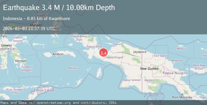
A 3.4 magnitude earthquake struck on West Papua Region, Indonesia, at Tue, 03 Mar 2026 21:37:39 GMT. Depth: 10km. Reviewed by BMKG seismologists, this minor quake occurred at a magnitude type of M.
Magnitude
3.4
M
Source
BMKG
Intensity
-
Agency Reports
1 Sources| Source | Magnitude | Depth | Time |
|---|---|---|---|
| BMKGPrimary | 3.4 | 10 km | 2 days ago |
Earthquake Details
ManualEvent IDbmg2026ejcm
Tsunami PotentialNo
Magnitude TypeM
Nearest Places
- 0.4 km
- 6.1 km
- 11.9 km
- 15.0 km
- 15.2 km
Comments
Join the discussion about this event.
Latest Earthquakes
1.9Mag
Central Alaska
Time19 hours ago
Depth9.77 km
SourceVYT (Automatic)
0.7Mag
8 km NW of The Geysers, CA
Time19 hours ago
Depth1.66 km
SourceUSGS (Automatic)
3.5Mag
Greece-Albania border region
Time19 hours ago
Depth1.59 km
SourceVYT (Automatic)
2.7Mag
CENTRAL TURKEY
Time19 hours ago
Depth5.00 km
SourceKOERI (Automatic)
1.0Mag
6 km WNW of The Geysers, CA
Time19 hours ago
Depth3.10 km
SourceUSGS (Automatic)
Nearby Earthquakes
6.0Mag
PAPUA, INDONESIA
Time13 years ago
Depth10.00 km
SourceEMSC (Automatic)
3.6Mag
West Papua Region, Indonesia
Time1 month ago
Depth10.00 km
SourceBMKG (Automatic)
3.0Mag
PAPUA, INDONESIA
Time2 months ago
Depth10.00 km
SourceBMKG (Automatic)
7.1Mag
PAPUA, INDONESIA
Time21 years ago
Depth33.00 km
SourceEMSC (Automatic)
2.8Mag
PAPUA, INDONESIA
Time2 months ago
Depth31.00 km
SourceBMKG (Automatic)