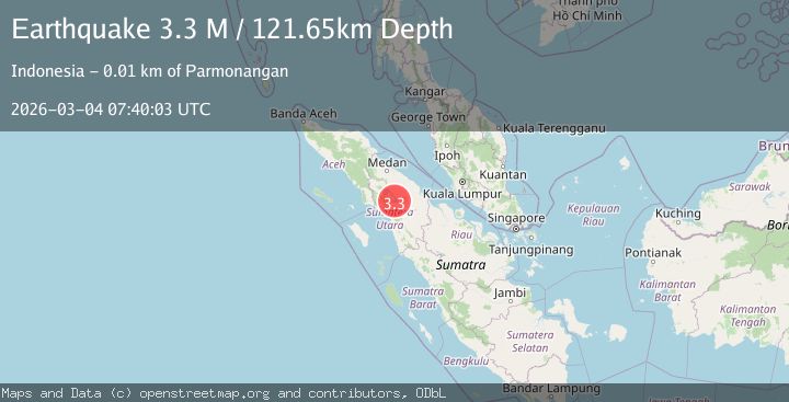
Earthquake Northern Sumatra, Indonesia
Wed, 04 Mar 2026 07:40:03 GMT
Time3 hours ago
Location
2.3850, 98.9947
Depth
121.6 KM
Event Summary
A 3.3 magnitude earthquake struck on Northern Sumatra, Indonesia, at Wed, 04 Mar 2026 07:40:03 GMT. Depth: 121.64679km. Reviewed by BMKG seismologists, this minor quake occurred at a magnitude type of M.
Magnitude
3.3
M
Source
BMKG
Intensity
-
Agency Reports
1 Sources| Source | Magnitude | Depth | Time |
|---|---|---|---|
| BMKGPrimary | 3.3 | 122 km | 3 hours ago |
Earthquake Details
ManualEvent IDbmg2026ejwj
Tsunami PotentialNo
Magnitude TypeM
Nearest Places
- 4.8 km
- 5.2 km
- 5.4 km
- 5.5 km
- 5.6 km
Comments
Join the discussion about this event.
Latest Earthquakes
1.3Mag
12 km SSE of Anza, CA
Time3 hours ago
Depth8.83 km
SourceUSGS (Automatic)
2.6Mag
Central Alaska
Time3 hours ago
Depth127.56 km
SourceVYT (Automatic)
2.7Mag
offshore Valparaiso, Chile
Time3 hours ago
Depth0.00 km
SourceVYT (Automatic)
1.3Mag
Southern Alaska
Time3 hours ago
Depth0.00 km
SourceVYT (Automatic)
1.6Mag
Central Alaska
Time3 hours ago
Depth76.05 km
SourceVYT (Automatic)
Nearby Earthquakes
5.2Mag
NORTHERN SUMATRA, INDONESIA
Time13 years ago
Depth157.00 km
SourceEMSC (Automatic)
5.0Mag
NORTHERN SUMATRA, INDONESIA
Time17 years ago
Depth150.00 km
SourceEMSC (Automatic)
3.8Mag
NORTHERN SUMATRA, INDONESIA
Time1 month ago
Depth154.00 km
SourceBMKG (Automatic)
5.1Mag
NORTHERN SUMATRA, INDONESIA
Time7 years ago
Depth158.00 km
SourceEMSC (Automatic)
3.2Mag
Northern Sumatra, Indonesia
Time1 month ago
Depth128.79 km
SourceBMKG (Automatic)