Earthquake Near North Coast of West Papua
Wed, 04 Mar 2026 19:21:25 GMT
Time2 hours ago
Location
-2.6730, 139.7852
Depth
67.7 KM
Event Summary
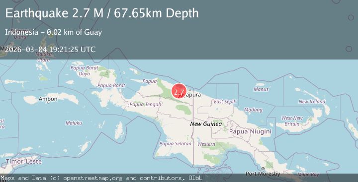
A 2.7 magnitude earthquake struck on Near North Coast of West Papua, at Wed, 04 Mar 2026 19:21:25 GMT. Depth: 67.650391km. Reviewed by BMKG seismologists, this minor quake occurred at a magnitude type of M.
Magnitude
2.7
M
Source
BMKG
Intensity
-
Agency Reports
1 Sources| Source | Magnitude | Depth | Time |
|---|---|---|---|
| BMKGPrimary | 2.7 | 68 km | 2 hours ago |
Earthquake Details
ManualEvent IDbmg2026ektn
Tsunami PotentialNo
Magnitude TypeM
Nearest Places
- 3.8 km
- 7.3 km
- 8.5 km
- 9.4 km
- 9.5 km
Comments
Join the discussion about this event.
Latest Earthquakes
2.3Mag
Flores Region, Indonesia
Time2 hours ago
Depth163.44 km
SourceBMKG
2.3Mag
northern Sumatra, Indonesia
Time2 hours ago
Depth0.00 km
SourceVYT (Automatic)
2.9Mag
Antofagasta, Chile
Time2 hours ago
Depth15.50 km
SourceVYT (Automatic)
3.8Mag
Rat Islands, Aleutian Islands, Alaska
Time2 hours ago
Depth10.00 km
SourceVYT (Automatic)
2.4Mag
near the north coast of Papua, Indonesia
Time2 hours ago
Depth40.04 km
SourceVYT (Automatic)
Nearby Earthquakes
3.0Mag
NEAR N COAST OF PAPUA, INDONESIA
Time2 years ago
Depth61.00 km
SourceDJA (Automatic)
5.0Mag
NEAR N COAST OF PAPUA, INDONESIA
Time18 years ago
Depth30.00 km
SourceEMSC (Automatic)
4.0Mag
NEAR N COAST OF PAPUA, INDONESIA
Time2 years ago
Depth12.00 km
SourceDJA (Automatic)
5.0Mag
NEAR N COAST OF PAPUA, INDONESIA
Time19 years ago
Depth20.00 km
SourceEMSC (Automatic)
2.6Mag
Near North Coast of West Papua
Time2 weeks ago
Depth10.00 km
SourceBMKG