Earthquake Northern Sumatra, Indonesia
Wed, 04 Mar 2026 21:04:51 GMT
Time4 hours ago
Location
2.3705, 98.6438
Depth
10.0 KM
Event Summary
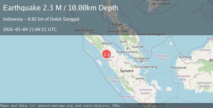
A 2.3 magnitude earthquake struck on Northern Sumatra, Indonesia, at Wed, 04 Mar 2026 21:04:51 GMT. Depth: 10km. Reviewed by BMKG seismologists, this minor quake occurred at a magnitude type of M.
Magnitude
2.3
M
Source
BMKG
Intensity
-
Agency Reports
1 Sources| Source | Magnitude | Depth | Time |
|---|---|---|---|
| BMKGPrimary | 2.3 | 10 km | 4 hours ago |
Earthquake Details
ManualEvent IDbmg2026ekwx
Tsunami PotentialNo
Magnitude TypeM
Nearest Places
- 4.0 km
- 4.7 km
- 5.2 km
- 5.5 km
- 5.9 km
Comments
Join the discussion about this event.
Latest Earthquakes
3.5Mag
Rat Islands, Aleutian Islands, Alaska
Time5 hours ago
Depth3.17 km
SourceVYT (Automatic)
1.0Mag
Southern Alaska
Time5 hours ago
Depth0.00 km
SourceVYT (Automatic)
3.8Mag
Wyoming
Time5 hours ago
Depth10.00 km
SourceVYT (Automatic)
2.6Mag
Fox Islands, Aleutian Islands, Alaska
Time5 hours ago
Depth0.00 km
SourceVYT (Automatic)
2.7Mag
AZORES ISLANDS, PORTUGAL
Time5 hours ago
Depth3.00 km
SourcePDA (Automatic)
Nearby Earthquakes
2.7Mag
northern Sumatra, Indonesia
Time1 week ago
Depth1.22 km
SourceVYT (Automatic)
3.7Mag
northern Sumatra, Indonesia
Time2 days ago
Depth10.50 km
SourceVYT (Automatic)
2.7Mag
Northern Sumatra, Indonesia
Time1 month ago
Depth8.59 km
SourceBMKG (Automatic)
2.5Mag
NORTHERN SUMATRA, INDONESIA
Time1 month ago
Depth13.00 km
SourceBMKG (Automatic)
2.5Mag
NORTHERN SUMATRA, INDONESIA
Time1 month ago
Depth1.00 km
SourceBMKG (Automatic)