Earthquake SOUTHERN YUKON TERRITORY, CANADA
Thu, 01 Jan 2026 07:17:01 GMT
Time3 hours ago
Location
60.4874, -140.4020
Depth
5.0 KM
Event Summary
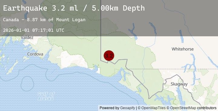
A 3.2 magnitude earthquake struck on SOUTHERN YUKON TERRITORY, CANADA, at Thu, 01 Jan 2026 07:17:01 GMT. Depth: 5km. Reviewed by EMSC seismologists, this minor quake occurred at a magnitude type of ml.
Magnitude
3.2
ml
Source
EMSC
Intensity
-
Earthquake Details
AutomaticEvent IDemsc_20260101_0000103
Tsunami PotentialNo
Magnitude Typeml
Nearest Places
- Mount Logan8.9 km
- McArthur Peak16.8 km
- King Peak17.4 km
- Mount Baird19.2 km
- Mount Augusta20.4 km
Comments
Join the discussion about this event.
Latest Earthquakes
1.3Mag
125 km SE of McCarthy, Alaska
Time2 hours ago
Depth5.00 km
SourceUSGS (Automatic)
2.4Mag
Java, Indonesia
Time2 hours ago
Depth13.23 km
SourceBMKG (Automatic)
2.5Mag
JAVA, INDONESIA
Time2 hours ago
Depth12.00 km
SourceEMSC (Automatic)
2.9Mag
SOUTHERN YUKON TERRITORY, CANADA
Time2 hours ago
Depth5.00 km
SourceEMSC (Automatic)
2.9Mag
103 km NNW of Yakutat, Alaska
Time2 hours ago
Depth5.00 km
SourceUSGS
Nearby Earthquakes
1.3Mag
125 km SE of McCarthy, Alaska
Time2 hours ago
Depth5.00 km
SourceUSGS (Automatic)
2.9Mag
SOUTHERN YUKON TERRITORY, CANADA
Time2 hours ago
Depth5.00 km
SourceEMSC (Automatic)
2.9Mag
103 km NNW of Yakutat, Alaska
Time2 hours ago
Depth5.00 km
SourceUSGS
2.6Mag
SOUTHERN YUKON TERRITORY, CANADA
Time2 hours ago
Depth5.00 km
SourceEMSC (Automatic)
2.6Mag
113 km NNW of Yakutat, Alaska
Time2 hours ago
Depth5.00 km
SourceUSGS