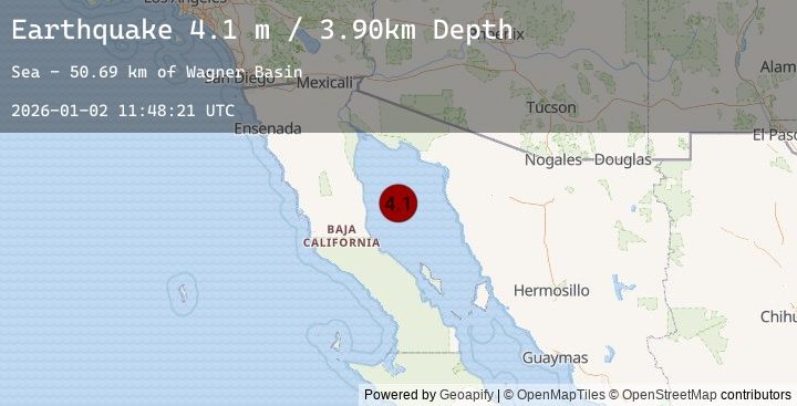
Earthquake GULF OF CALIFORNIA
Fri, 02 Jan 2026 11:48:21 GMT
Time2 hours ago
Location
30.5940, -114.0070
Depth
3.9 KM
Event Summary
A 4.1 magnitude earthquake struck on GULF OF CALIFORNIA, at Fri, 02 Jan 2026 11:48:21 GMT. Depth: 3.9km. Reviewed by UNM seismologists, this light quake occurred at a magnitude type of m.
Magnitude
4.1
m
Source
UNM
Intensity
-
Agency Reports
1 Sources| Source | Magnitude | Depth | Time |
|---|---|---|---|
| UNMPrimary | 4.1 | 4 km | 2 hours ago |
Earthquake Details
AutomaticEvent IDemsc_20260102_0000151
Tsunami PotentialNo
Magnitude Typem
Nearest Places
- Wagner Basin47.6 km
- Punta San Fermin59.7 km
- Matomi61.3 km
- El Canelo62.5 km
- Los Heme62.8 km
Comments
Join the discussion about this event.
Latest Earthquakes
2.0Mag
10 km SE of Pāhala, Hawaii
Time1 hour ago
Depth31.79 km
SourceUSGS (Automatic)
2.6Mag
Sumbawa Region, Indonesia
Time2 hours ago
Depth29.02 km
SourceBMKG (Automatic)
2.3Mag
Java, Indonesia
Time2 hours ago
Depth85.21 km
SourceBMKG (Automatic)
2.1Mag
Java, Indonesia
Time2 hours ago
Depth28.43 km
SourceBMKG (Automatic)
4.2Mag
COQUIMBO, CHILE
Time2 hours ago
Depth37.10 km
SourceCSN (Automatic)