Earthquake GULF OF CALIFORNIA
Sat, 10 Jan 2026 18:25:19 GMT
Time1 day ago
Location
28.0040, -112.1150
Depth
5.2 KM
Event Summary
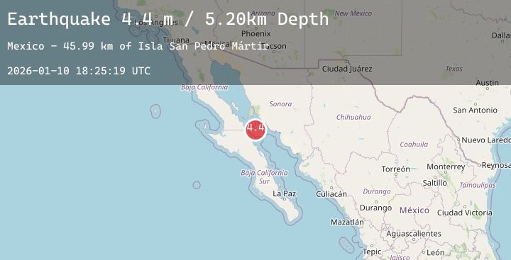
A 4.4 magnitude earthquake struck on GULF OF CALIFORNIA, at Sat, 10 Jan 2026 18:25:19 GMT. Depth: 5.2km. Reviewed by UNM seismologists, this light quake occurred at a magnitude type of m.
Magnitude
4.4
m
Source
UNM
Intensity
-
Agency Reports
1 Sources| Source | Magnitude | Depth | Time |
|---|---|---|---|
| UNMPrimary | 4.4 | 5 km | 1 day ago |
Earthquake Details
AutomaticEvent IDemsc_20260110_0000242
Tsunami PotentialNo
Magnitude Typem
Nearest Places
- Isla San Pedro Mártir45.9 km
- San Pedro Mártir Basin52.6 km
- La Reforma Vieja54.9 km
- Cuesta del Alamo55.0 km
- Punta El Gato55.2 km
Comments
Join the discussion about this event.
Latest Earthquakes
3.7Mag
Banda Sea
Time1 day ago
Depth297.21 km
SourceBMKG (Automatic)
1.0Mag
2 km WNW of The Geysers, CA
Time1 day ago
Depth1.86 km
SourceUSGS (Automatic)
1.8Mag
5 km NNE of Pāhala, Hawaii
Time1 day ago
Depth8.68 km
SourceUSGS (Automatic)
4.5Mag
JAN MAYEN ISLAND REGION
Time1 day ago
Depth10.00 km
SourceGFZ (Automatic)
2.4Mag
WESTERN TURKEY
Time1 day ago
Depth9.00 km
SourceAFAD (Automatic)
Nearby Earthquakes
No significant earthquakes nearby recently.