Earthquake VIRGIN ISLANDS REGION
Tue, 13 Jan 2026 12:38:55 GMT
Time1 day ago
Location
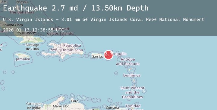
18.2645, -64.7163
Depth
13.5 KM
Event Summary
A 2.7 magnitude earthquake struck on VIRGIN ISLANDS REGION, at Tue, 13 Jan 2026 12:38:55 GMT. Depth: 13.5km. Reviewed by PR seismologists, this minor quake occurred at a magnitude type of md.
Magnitude
2.7
md
Source
PR
Intensity
-
Agency Reports
1 Sources| Source | Magnitude | Depth | Time |
|---|---|---|---|
| PRPrimary | 2.7 | 14 km | 1 day ago |
Earthquake Details
AutomaticEvent IDemsc_20260113_0000189
Tsunami PotentialNo
Magnitude Typemd
Nearest Places
- Virgin Islands Coral Reef National Monument3.0 km
- Ram Head4.0 km
- Estate Mandal4.2 km
- Booby Rock4.2 km
- Dunk Bay Trail4.3 km
Comments
Join the discussion about this event.
Latest Earthquakes
2.6Mag
West Papua Region, Indonesia
Time1 day ago
Depth10.00 km
SourceBMKG (Automatic)
1.9Mag
31 km E of Pāhala, Hawaii
Time1 day ago
Depth0.69 km
SourceUSGS (Automatic)
2.5Mag
28 km S of Volcano, Hawaii
Time1 day ago
Depth40.57 km
SourceUSGS (Automatic)
2.3Mag
CENTRAL CALIFORNIA
Time1 day ago
Depth23.70 km
SourceNC (Automatic)
1.5Mag
SWITZERLAND
Time1 day ago
Depth3.70 km
SourceETHZ (Automatic)
Nearby Earthquakes
No significant earthquakes nearby recently.