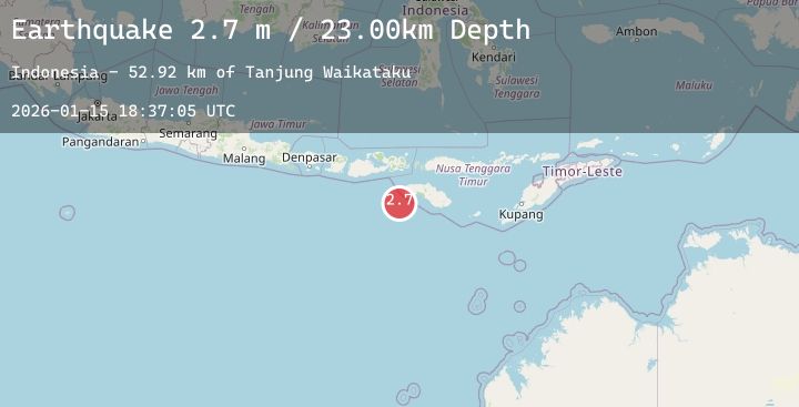
Earthquake SOUTH OF SUMBAWA, INDONESIA
Thu, 15 Jan 2026 18:37:05 GMT
Time5 hours ago
Location
-10.1000, 118.8000
Depth
23.0 KM
Event Summary
A 2.7 magnitude earthquake struck on SOUTH OF SUMBAWA, INDONESIA, at Thu, 15 Jan 2026 18:37:05 GMT. Depth: 23km. Reviewed by BMKG seismologists, this minor quake occurred at a magnitude type of m.
Magnitude
2.7
m
Source
BMKG
Intensity
-
Agency Reports
1 Sources| Source | Magnitude | Depth | Time |
|---|---|---|---|
| BMKGPrimary | 2.7 | 23 km | 5 hours ago |
Earthquake Details
AutomaticEvent IDemsc_20260115_0000291
Tsunami PotentialNo
Magnitude Typem
Nearest Places
- Tanjung Waikataku52.9 km
- Loko Waikataku53.0 km
- Tanjung Mareha53.4 km
- Tanjung Waibuku53.4 km
- Pandapia53.5 km
Comments
Join the discussion about this event.
Latest Earthquakes
2.2Mag
Java, Indonesia
Time5 hours ago
Depth95.93 km
SourceBMKG (Automatic)
1.3Mag
15 km NNW of Stanton, Texas
Time5 hours ago
Depth4.28 km
SourceUSGS (Automatic)
1.4Mag
93 km NNW of Yakutat, Alaska
Time5 hours ago
Depth5.00 km
SourceUSGS (Automatic)
3.5Mag
South of Bali, Indonesia
Time5 hours ago
Depth10.00 km
SourceBMKG (Automatic)
4.3Mag
SOUTHERN PERU
Time5 hours ago
Depth130.00 km
SourceLIM (Automatic)