Earthquake MYANMAR-INDIA BORDER REGION
Sat, 17 Jan 2026 23:22:20 GMT
Time1 hour ago
Location
23.7000, 93.7900
Depth
65.0 KM
Event Summary
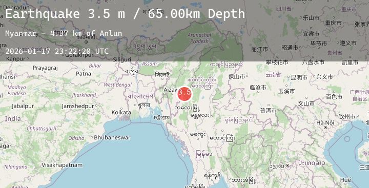
A 3.5 magnitude earthquake struck on MYANMAR-INDIA BORDER REGION, at Sat, 17 Jan 2026 23:22:20 GMT. Depth: 65km. Reviewed by NDI seismologists, this minor quake occurred at a magnitude type of m.
Magnitude
3.5
m
Source
NDI
Intensity
-
Agency Reports
1 Sources| Source | Magnitude | Depth | Time |
|---|---|---|---|
| NDIPrimary | 3.5 | 65 km | 1 hour ago |
Earthquake Details
AutomaticEvent IDemsc_20260117_0000291
Tsunami PotentialNo
Magnitude Typem
Comments
Join the discussion about this event.
Latest Earthquakes
2.3Mag
Java, Indonesia
Time1 hour ago
Depth8.25 km
SourceBMKG (Automatic)
2.6Mag
55 km WNW of Sitka, Alaska
Time1 hour ago
Depth11.80 km
SourceUSGS (Automatic)
2.8Mag
CATAMARCA, ARGENTINA
Time1 hour ago
Depth135.00 km
SourceNSNA (Automatic)
3.0Mag
SOUTH ISLAND OF NEW ZEALAND
Time1 hour ago
Depth81.20 km
SourceGNS (Automatic)
1.6Mag
17 km E of Ocotillo Wells, CA
Time1 hour ago
Depth7.70 km
SourceUSGS (Automatic)
Nearby Earthquakes
No significant earthquakes nearby recently.