Earthquake 55 km WNW of Sitka, Alaska
Sat, 17 Jan 2026 23:24:17 GMT
Time1 hour ago
Location
57.2320, -136.1950
Depth
11.8 KM
Event Summary
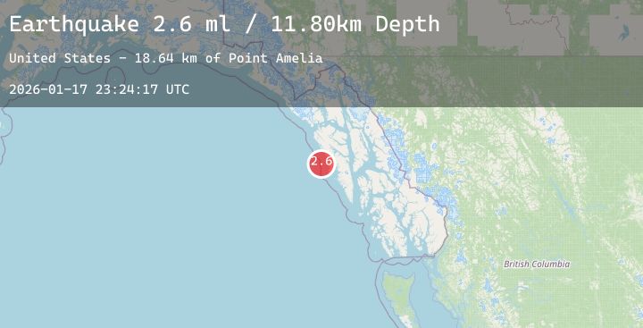
A 2.6 magnitude earthquake struck on 55 km WNW of Sitka, Alaska, at Sat, 17 Jan 2026 23:24:17 GMT. Depth: 11.8km. Reviewed by USGS seismologists, this minor quake occurred at a magnitude type of ml.
Magnitude
2.6
ml
Source
USGS
Intensity
-
Agency Reports
1 Sources| Source | Magnitude | Depth | Time |
|---|---|---|---|
| USGSPrimary | 2.6 | 12 km | 1 hour ago |
Earthquake Details
AutomaticEvent IDusgs_ak2026bfeeez
Tsunami PotentialNo
Magnitude Typeml
Nearest Places
- Point Amelia19.3 km
- Sealion Island19.6 km
- Sealion Islands20.0 km
- Twin Point20.8 km
- Eagle Rock20.9 km
Comments
Join the discussion about this event.
Latest Earthquakes
1.6Mag
17 km E of Ocotillo Wells, CA
Time1 hour ago
Depth7.70 km
SourceUSGS (Automatic)
3.4Mag
Mindanao, Philippines
Time1 hour ago
Depth10.00 km
SourceBMKG (Automatic)
2.0Mag
6 km SW of Volcano, Hawaii
Time1 hour ago
Depth1.61 km
SourceUSGS (Automatic)
2.4Mag
AZORES ISLANDS, PORTUGAL
Time2 hours ago
Depth7.00 km
SourcePDA (Automatic)
1.6Mag
10 km W of Houston, Alaska
Time2 hours ago
Depth29.10 km
SourceUSGS (Automatic)