Earthquake WESTERN AUSTRALIA
Tue, 06 Jan 2026 18:30:56 GMT
Time1 month ago
Location
-22.2000, 128.7100
Depth
36.0 KM
Event Summary
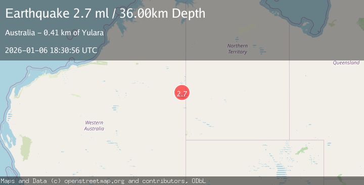
A 2.7 magnitude earthquake struck on WESTERN AUSTRALIA, at Tue, 06 Jan 2026 18:30:56 GMT. Depth: 36km. Reviewed by AUST seismologists, this minor quake occurred at a magnitude type of ml.
Magnitude
2.7
ml
Source
AUST
Intensity
-
Agency Reports
1 Sources| Source | Magnitude | Depth | Time |
|---|---|---|---|
| AUSTPrimary | 2.7 | 36 km | 1 month ago |
Earthquake Details
AutomaticEvent IDemsc_AUST_20260106_0000423
Tsunami PotentialNo
Magnitude Typeml
Nearest Places
- 18.6 km
- 18.8 km
- 20.7 km
- 28.7 km
- 32.0 km
Comments
Join the discussion about this event.
Latest Earthquakes
2.6Mag
Tarapaca, Chile
Time15 hours ago
Depth106.08 km
SourceVYT (Automatic)
1.4Mag
Southern Alaska
Time15 hours ago
Depth28.32 km
SourceVYT (Automatic)
2.4Mag
northwestern Russia
Time15 hours ago
Depth10.00 km
SourceVYT (Automatic)
2.3Mag
FRANCE
Time15 hours ago
Depth5.00 km
SourceReNaSS (Automatic)
2.5Mag
Java, Indonesia
Time16 hours ago
Depth14.16 km
SourceVYT (Automatic)
Nearby Earthquakes
2.7Mag
WESTERN AUSTRALIA
Time1 month ago
Depth22.00 km
SourceAUST (Automatic)
2.8Mag
WESTERN AUSTRALIA
Time2 weeks ago
Depth10.00 km
SourceAUST (Automatic)
3.0Mag
WESTERN AUSTRALIA
Time8 years ago
Depth10.00 km
SourceAUST (Automatic)
3.0Mag
NORTHERN TERRITORY, AUSTRALIA
Time8 years ago
Depth10.00 km
SourceAUST (Automatic)
2.1Mag
Western Australia
Time1 week ago
Depth226.93 km
SourceVYT (Automatic)