Earthquake WESTERN AUSTRALIA
Sat, 10 Jan 2026 09:39:22 GMT
Time1 month ago
Location
-30.6300, 121.4400
Depth
2.0 KM
Event Summary
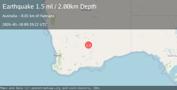
A 1.5 magnitude earthquake struck on WESTERN AUSTRALIA, at Sat, 10 Jan 2026 09:39:22 GMT. Depth: 2km. Reviewed by AUST seismologists, this minor quake occurred at a magnitude type of ml.
Magnitude
1.5
ml
Source
AUST
Intensity
-
Agency Reports
1 Sources| Source | Magnitude | Depth | Time |
|---|---|---|---|
| AUSTPrimary | 1.5 | 2 km | 1 month ago |
Earthquake Details
AutomaticEvent IDemsc_AUST_20260110_0000119
Tsunami PotentialNo
Magnitude Typeml
Nearest Places
- Gidji Siding3.4 km
- Eight Mile Dam3.4 km
- Ten Mile Dam6.1 km
- Five Mile Hill6.5 km
- Gidji Dam6.8 km
Comments
Join the discussion about this event.
Latest Earthquakes
2.8Mag
Antofagasta, Chile
Time1 minute ago
Depth110.47 km
SourceVYT (Automatic)
3.2Mag
Southeastern Alaska
Time2 minutes ago
Depth0.00 km
SourceVYT (Automatic)
2.8Mag
Sunda Strait, Indonesia
Time13 minutes ago
Depth3.61 km
SourceBMKG
3.6Mag
south of Alaska
Time14 minutes ago
Depth10.00 km
SourceVYT (Automatic)
1.2Mag
Central Alaska
Time16 minutes ago
Depth68.97 km
SourceVYT (Automatic)
Nearby Earthquakes
3.0Mag
WESTERN AUSTRALIA
Time7 years ago
Depth10.00 km
SourceAUST (Automatic)
1.6Mag
Western Australia
Time2 days ago
Depth6.47 km
SourceVYT (Automatic)
3.0Mag
WESTERN AUSTRALIA
Time1 year ago
Depth10.00 km
SourceAUST (Automatic)
3.0Mag
WESTERN AUSTRALIA
Time1 year ago
Depth3.00 km
SourceAUST (Automatic)
3.0Mag
WESTERN AUSTRALIA
Time3 years ago
Depth5.00 km
SourceAUST (Automatic)