Earthquake WESTERN AUSTRALIA
Fri, 13 Feb 2026 22:57:39 GMT
Time1 week ago
Location
-33.8300, 117.9200
Depth
5.0 KM
Event Summary
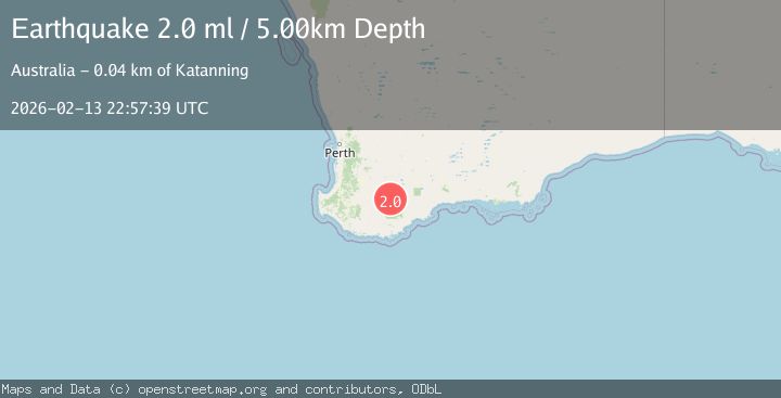
A 2.0 magnitude earthquake struck on WESTERN AUSTRALIA, at Fri, 13 Feb 2026 22:57:39 GMT. Depth: 5km. Reviewed by AUST seismologists, this minor quake occurred at a magnitude type of ml.
Magnitude
2.0
ml
Source
AUST
Intensity
-
Agency Reports
1 Sources| Source | Magnitude | Depth | Time |
|---|---|---|---|
| AUSTPrimary | 2.0 | 5 km | 1 week ago |
Earthquake Details
AutomaticEvent IDemsc_AUST_20260213_0000387
Tsunami PotentialNo
Magnitude Typeml
Nearest Places
- 1.8 km
- 2.4 km
- 2.8 km
- 3.0 km
- 3.7 km
Comments
Join the discussion about this event.
Latest Earthquakes
1.8Mag
13 km SSE of Smiley, Texas
Time5 minutes ago
Depth10.45 km
SourceUSGS (Automatic)
1.8Mag
off the coast of Tarapaca, Chile
Time6 minutes ago
Depth8.18 km
SourceVYT (Automatic)
2.2Mag
WESTERN TURKEY
Time7 minutes ago
Depth7.90 km
SourceKOERI (Automatic)
1.3Mag
western Texas
Time9 minutes ago
Depth11.23 km
SourceVYT (Automatic)
2.2Mag
Sumbawa Region, Indonesia
Time13 minutes ago
Depth23.16 km
SourceBMKG
Nearby Earthquakes
2.2Mag
WESTERN AUSTRALIA
Time2 weeks ago
Depth5.00 km
SourceAUST (Automatic)
2.2Mag
WESTERN AUSTRALIA
Time1 week ago
Depth5.00 km
SourceAUST (Automatic)
2.1Mag
WESTERN AUSTRALIA
Time1 week ago
Depth2.00 km
SourceAUST (Automatic)
2.0Mag
WESTERN AUSTRALIA
Time1 week ago
Depth5.00 km
SourceAUST (Automatic)
2.0Mag
WESTERN AUSTRALIA
Time5 days ago
Depth5.00 km
SourceAUST (Automatic)