Earthquake WESTERN AUSTRALIA
Wed, 18 Feb 2026 06:26:06 GMT
Time5 days ago
Location
-33.8359, 117.9198
Depth
5.0 KM
Event Summary
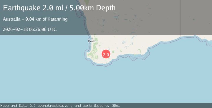
A 2.0 magnitude earthquake struck on WESTERN AUSTRALIA, at Wed, 18 Feb 2026 06:26:06 GMT. Depth: 5km. Reviewed by AUST seismologists, this minor quake occurred at a magnitude type of ml.
Magnitude
2.0
ml
Source
AUST
Intensity
-
Agency Reports
1 Sources| Source | Magnitude | Depth | Time |
|---|---|---|---|
| AUSTPrimary | 2.0 | 5 km | 5 days ago |
Earthquake Details
AutomaticEvent IDemsc_AUST_20260218_0000361
Tsunami PotentialNo
Magnitude Typeml
Nearest Places
- 1.9 km
- 2.3 km
- 3.0 km
- 3.1 km
- 3.5 km
Comments
Join the discussion about this event.
Latest Earthquakes
2.7Mag
Ceram Sea
Time5 hours ago
Depth4.50 km
SourceBMKG
1.1Mag
9 km NNW of Cabazon, CA
Time5 hours ago
Depth15.87 km
SourceUSGS (Automatic)
1.2Mag
4 km W of Lake Henshaw, CA
Time5 hours ago
Depth11.89 km
SourceUSGS (Automatic)
4.3Mag
OFF EAST COAST OF HONSHU, JAPAN
Time5 hours ago
Depth30.00 km
SourceJMA (Automatic)
1.9Mag
Sumbawa region, Indonesia
Time6 hours ago
Depth21.00 km
SourceVYT (Automatic)
Nearby Earthquakes
2.1Mag
WESTERN AUSTRALIA
Time1 day ago
Depth5.00 km
SourceAUST (Automatic)
2.0Mag
WESTERN AUSTRALIA
Time1 week ago
Depth5.00 km
SourceAUST (Automatic)
2.0Mag
WESTERN AUSTRALIA
Time1 week ago
Depth5.00 km
SourceAUST (Automatic)
2.2Mag
WESTERN AUSTRALIA
Time1 week ago
Depth1.00 km
SourceAUST (Automatic)
2.1Mag
WESTERN AUSTRALIA
Time3 days ago
Depth1.30 km
SourceAUST (Automatic)