Earthquake WESTERN AUSTRALIA
Thu, 19 Feb 2026 21:11:48 GMT
Time3 days ago
Location
-33.8117, 117.9098
Depth
0.6 KM
Event Summary
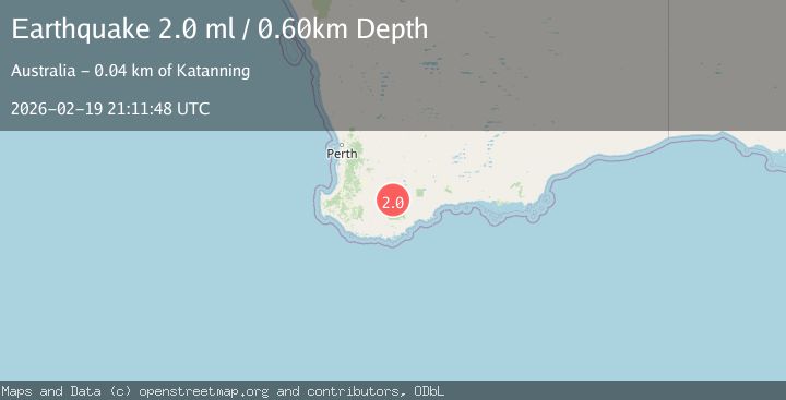
A 2.0 magnitude earthquake struck on WESTERN AUSTRALIA, at Thu, 19 Feb 2026 21:11:48 GMT. Depth: 0.6km. Reviewed by AUST seismologists, this minor quake occurred at a magnitude type of ml.
Magnitude
2.0
ml
Source
AUST
Intensity
-
Agency Reports
1 Sources| Source | Magnitude | Depth | Time |
|---|---|---|---|
| AUSTPrimary | 2.0 | 1 km | 3 days ago |
Earthquake Details
AutomaticEvent IDemsc_AUST_20260219_0000375
Tsunami PotentialNo
Magnitude Typeml
Nearest Places
- 1.4 km
- 3.4 km
- 3.6 km
- 4.4 km
- 4.5 km
Comments
Join the discussion about this event.
Latest Earthquakes
3.4Mag
Minahasa, Sulawesi, Indonesia
Time12 hours ago
Depth187.38 km
SourceVYT (Automatic)
3.6Mag
ANTOFAGASTA, CHILE
Time12 hours ago
Depth123.40 km
SourceCSN (Automatic)
3.3Mag
Central Alaska
Time12 hours ago
Depth3.05 km
SourceVYT (Automatic)
2.9Mag
ALBANIA
Time12 hours ago
Depth15.00 km
SourceIGEO (Automatic)
4.3Mag
GUATEMALA
Time12 hours ago
Depth277.00 km
SourceINET (Automatic)
Nearby Earthquakes
2.4Mag
WESTERN AUSTRALIA
Time1 week ago
Depth2.00 km
SourceAUST (Automatic)
2.4Mag
WESTERN AUSTRALIA
Time1 week ago
Depth1.00 km
SourceAUST (Automatic)
2.4Mag
WESTERN AUSTRALIA
Time1 week ago
Depth1.00 km
SourceAUST (Automatic)
2.2Mag
WESTERN AUSTRALIA
Time1 week ago
Depth1.00 km
SourceAUST (Automatic)
2.1Mag
WESTERN AUSTRALIA
Time6 days ago
Depth5.00 km
SourceAUST (Automatic)