Earthquake LOMBOK REGION, INDONESIA
Sat, 03 Jan 2026 18:39:22 GMT
Time1 month ago
Location
-9.3600, 116.4100
Depth
10.0 KM
Event Summary
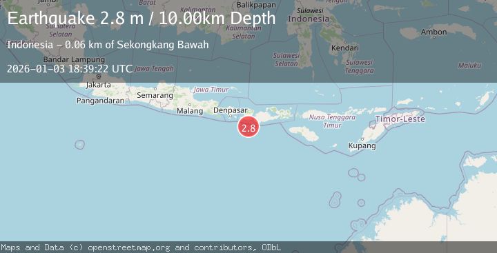
A 2.8 magnitude earthquake struck on LOMBOK REGION, INDONESIA, at Sat, 03 Jan 2026 18:39:22 GMT. Depth: 10km. Reviewed by BMKG seismologists, this minor quake occurred at a magnitude type of m.
Magnitude
2.8
m
Source
BMKG
Intensity
-
Agency Reports
1 Sources| Source | Magnitude | Depth | Time |
|---|---|---|---|
| BMKGPrimary | 2.8 | 10 km | 1 month ago |
Earthquake Details
AutomaticEvent IDemsc_BMKG_20260103_0000253
Tsunami PotentialNo
Magnitude Typem
Nearest Places
- Pulau Gilisaya44.0 km
- Tanjung Bilesayang45.1 km
- Gili Sayang45.2 km
- Gili Nyepuq45.2 km
- Tanjung Bungkulan45.4 km
Comments
Join the discussion about this event.
Latest Earthquakes
3.4Mag
Flores region, Indonesia
Time18 hours ago
Depth22.83 km
SourceVYT (Automatic)
2.4Mag
Sumbawa Region, Indonesia
Time18 hours ago
Depth10.00 km
SourceBMKG
1.3Mag
3 km SSW of Cobb, CA
Time18 hours ago
Depth0.36 km
SourceUSGS (Automatic)
1.8Mag
Southern California
Time18 hours ago
Depth13.43 km
SourceVYT (Automatic)
1.9Mag
Southern Alaska
Time18 hours ago
Depth0.00 km
SourceVYT (Automatic)
Nearby Earthquakes
2.1Mag
Sumbawa Region, Indonesia
Time6 days ago
Depth10.00 km
SourceBMKG
2.5Mag
LOMBOK REGION, INDONESIA
Time1 month ago
Depth35.00 km
SourceBMKG (Automatic)
2.7Mag
Sumbawa Region, Indonesia
Time3 weeks ago
Depth29.18 km
SourceBMKG (Automatic)
3.0Mag
LOMBOK REGION, INDONESIA
Time4 months ago
Depth46.00 km
SourceBMKG (Automatic)
3.0Mag
LOMBOK REGION, INDONESIA
Time11 months ago
Depth35.00 km
SourceBMKG (Automatic)