Earthquake NEAR N COAST OF PAPUA, INDONESIA
Sun, 04 Jan 2026 01:00:02 GMT
Time1 month ago
Location
-2.8900, 136.3800
Depth
74.0 KM
Event Summary
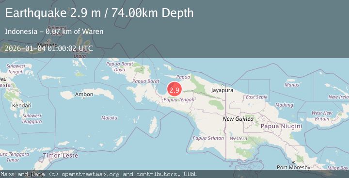
A 2.9 magnitude earthquake struck on NEAR N COAST OF PAPUA, INDONESIA, at Sun, 04 Jan 2026 01:00:02 GMT. Depth: 74km. Reviewed by BMKG seismologists, this minor quake occurred at a magnitude type of m.
Magnitude
2.9
m
Source
BMKG
Intensity
-
Agency Reports
1 Sources| Source | Magnitude | Depth | Time |
|---|---|---|---|
| BMKGPrimary | 2.9 | 74 km | 1 month ago |
Earthquake Details
AutomaticEvent IDemsc_BMKG_20260104_0000012
Tsunami PotentialNo
Magnitude Typem
Nearest Places
- Kampung Dokis1.9 km
- Kampung Kamarisano4.1 km
- Kampung Syewa Merare6.7 km
- Kampung Waweri9.2 km
- Buiwa10.1 km
Comments
Join the discussion about this event.
Latest Earthquakes
2.8Mag
Poland
Time14 hours ago
Depth10.50 km
SourceVYT (Automatic)
2.1Mag
Northern Sumatra, Indonesia
Time14 hours ago
Depth65.56 km
SourceBMKG
1.1Mag
Central Alaska
Time15 hours ago
Depth74.95 km
SourceVYT (Automatic)
3.8Mag
Atacama, Chile
Time15 hours ago
Depth113.40 km
SourceVYT (Automatic)
1.4Mag
Southeastern Alaska
Time15 hours ago
Depth0.00 km
SourceVYT (Automatic)
Nearby Earthquakes
3.0Mag
NEAR N COAST OF PAPUA, INDONESIA
Time2 months ago
Depth51.00 km
SourceBMKG (Automatic)
3.2Mag
NEAR N COAST OF PAPUA, INDONESIA
Time1 month ago
Depth77.00 km
SourceBMKG (Automatic)
3.0Mag
NEAR N COAST OF PAPUA, INDONESIA
Time4 months ago
Depth32.00 km
SourceBMKG (Automatic)
5.2Mag
NEAR N COAST OF PAPUA, INDONESIA
Time16 years ago
Depth40.00 km
SourceEMSC (Automatic)
2.9Mag
PAPUA, INDONESIA
Time1 month ago
Depth38.00 km
SourceBMKG (Automatic)