Earthquake NORTHERN SUMATRA, INDONESIA
Sun, 04 Jan 2026 15:17:18 GMT
Time1 month ago
Location
3.4800, 96.7100
Depth
13.0 KM
Event Summary
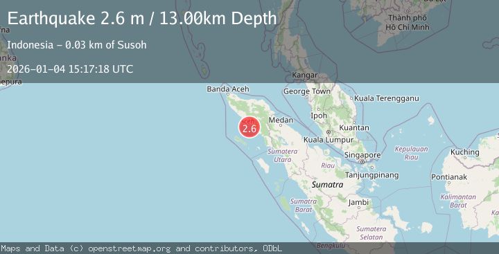
A 2.6 magnitude earthquake struck on NORTHERN SUMATRA, INDONESIA, at Sun, 04 Jan 2026 15:17:18 GMT. Depth: 13km. Reviewed by BMKG seismologists, this minor quake occurred at a magnitude type of m.
Magnitude
2.6
m
Source
BMKG
Intensity
-
Agency Reports
1 Sources| Source | Magnitude | Depth | Time |
|---|---|---|---|
| BMKGPrimary | 2.6 | 13 km | 1 month ago |
Earthquake Details
AutomaticEvent IDemsc_BMKG_20260104_0000219
Tsunami PotentialNo
Magnitude Typem
Nearest Places
- Ujung Manggeng25.4 km
- Aluerambat26.2 km
- Kuala Udeung26.2 km
- Padangmakmur26.3 km
- Gampong Alue Rambot26.4 km
Comments
Join the discussion about this event.
Latest Earthquakes
2.5Mag
Bering Strait
Time4 minutes ago
Depth200.07 km
SourceVYT (Automatic)
2.3Mag
Sumbawa Region, Indonesia
Time5 minutes ago
Depth10.00 km
SourceBMKG
1.6Mag
13 km ENE of Falls City, Texas
Time14 minutes ago
Depth7.18 km
SourceUSGS (Automatic)
1.5Mag
EASTERN TURKEY
Time17 minutes ago
Depth7.00 km
SourceAFAD (Automatic)
1.3Mag
5 km S of Cabazon, CA
Time18 minutes ago
Depth5.80 km
SourceUSGS (Automatic)
Nearby Earthquakes
3.0Mag
NORTHERN SUMATRA, INDONESIA
Time2 years ago
Depth20.00 km
SourceBMKG (Automatic)
2.3Mag
Northern Sumatra, Indonesia
Time2 weeks ago
Depth6.40 km
SourceBMKG (Automatic)
4.0Mag
NORTHERN SUMATRA, INDONESIA
Time1 year ago
Depth29.00 km
SourceBMKG (Automatic)
5.0Mag
NORTHERN SUMATRA, INDONESIA
Time21 years ago
Depth33.00 km
SourceEMSC (Automatic)
3.0Mag
NORTHERN SUMATRA, INDONESIA
Time4 years ago
Depth10.00 km
SourceDJA (Automatic)