Earthquake EAST TIMOR REGION
Tue, 06 Jan 2026 03:06:26 GMT
Time1 month ago
Location
-8.7800, 125.0500
Depth
83.0 KM
Event Summary
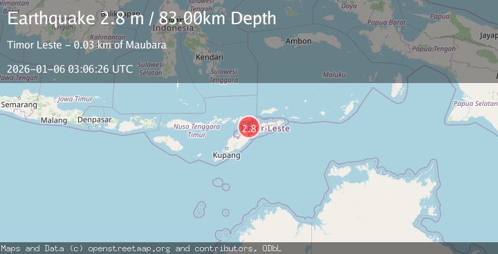
A 2.8 magnitude earthquake struck on EAST TIMOR REGION, at Tue, 06 Jan 2026 03:06:26 GMT. Depth: 83km. Reviewed by BMKG seismologists, this minor quake occurred at a magnitude type of m.
Magnitude
2.8
m
Source
BMKG
Intensity
-
Agency Reports
1 Sources| Source | Magnitude | Depth | Time |
|---|---|---|---|
| BMKGPrimary | 2.8 | 83 km | 1 month ago |
Earthquake Details
AutomaticEvent IDemsc_BMKG_20260106_0000044
Tsunami PotentialNo
Magnitude Typem
Nearest Places
- Mota Berita5.2 km
- Makate5.3 km
- Kotalaran5.4 km
- Mota Fatumolin5.5 km
- Enelaran5.6 km
Comments
Join the discussion about this event.
Latest Earthquakes
3.1Mag
Halmahera, Indonesia
Time8 minutes ago
Depth113.40 km
SourceVYT (Automatic)
1.0Mag
6 km WNW of Cobb, CA
Time8 minutes ago
Depth1.71 km
SourceUSGS (Automatic)
1.5Mag
Southern Alaska
Time9 minutes ago
Depth19.90 km
SourceVYT (Automatic)
1.9Mag
British Columbia, Canada
Time18 minutes ago
Depth0.00 km
SourceVYT (Automatic)
0.7Mag
84 km S of McCarthy, Alaska
Time20 minutes ago
Depth11.40 km
SourceUSGS (Automatic)
Nearby Earthquakes
2.6Mag
EAST TIMOR REGION
Time1 week ago
Depth7.00 km
SourceBMKG (Automatic)
3.0Mag
KEPULAUAN ALOR, INDONESIA
Time9 months ago
Depth10.00 km
SourceBMKG (Automatic)
3.0Mag
EAST TIMOR REGION
Time3 months ago
Depth10.00 km
SourceBMKG (Automatic)
2.7Mag
KEPULAUAN ALOR, INDONESIA
Time1 month ago
Depth7.00 km
SourceBMKG (Automatic)
2.7Mag
Timor Region
Time3 weeks ago
Depth16.38 km
SourceBMKG (Automatic)