Earthquake NEAR N COAST OF PAPUA, INDONESIA
Wed, 07 Jan 2026 02:14:53 GMT
Time1 month ago
Location
-2.1700, 139.5600
Depth
47.0 KM
Event Summary
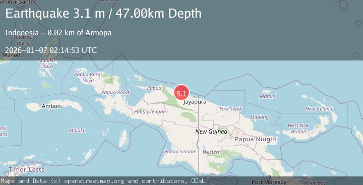
A 3.1 magnitude earthquake struck on NEAR N COAST OF PAPUA, INDONESIA, at Wed, 07 Jan 2026 02:14:53 GMT. Depth: 47km. Reviewed by BMKG seismologists, this minor quake occurred at a magnitude type of m.
Magnitude
3.1
m
Source
BMKG
Intensity
-
Agency Reports
1 Sources| Source | Magnitude | Depth | Time |
|---|---|---|---|
| BMKGPrimary | 3.1 | 47 km | 1 month ago |
Earthquake Details
AutomaticEvent IDemsc_BMKG_20260107_0000042
Tsunami PotentialNo
Magnitude Typem
Nearest Places
- Pulau Mengge3.1 km
- Kepulauan Podena4.6 km
- Pulau Anus6.9 km
- Pulau Kaitjebo7.0 km
- Pulau Kaicebo7.6 km
Comments
Join the discussion about this event.
Latest Earthquakes
1.3Mag
54 km WNW of Toyah, Texas
Time5 hours ago
Depth0.00 km
SourceUSGS (Automatic)
2.9Mag
Oruro, Bolivia
Time5 hours ago
Depth189.21 km
SourceVYT (Automatic)
3.4Mag
OFF COAST OF COSTA RICA
Time5 hours ago
Depth10.00 km
SourceINET (Automatic)
2.0Mag
Central Alaska
Time5 hours ago
Depth56.15 km
SourceVYT (Automatic)
2.6Mag
Antofagasta, Chile
Time5 hours ago
Depth0.00 km
SourceVYT (Automatic)
Nearby Earthquakes
2.7Mag
Near North Coast of West Papua
Time2 weeks ago
Depth22.48 km
SourceBMKG (Automatic)
2.5Mag
NEAR N COAST OF PAPUA, INDONESIA
Time2 weeks ago
Depth25.00 km
SourceBMKG (Automatic)
3.0Mag
NEAR N COAST OF PAPUA, INDONESIA
Time4 months ago
Depth25.00 km
SourceBMKG (Automatic)
5.5Mag
NEAR N COAST OF PAPUA, INDONESIA
Time12 years ago
Depth10.00 km
SourceEMSC (Automatic)
3.1Mag
NEAR N COAST OF PAPUA, INDONESIA
Time1 month ago
Depth36.00 km
SourceBMKG (Automatic)