Earthquake NORTHERN SUMATRA, INDONESIA
Wed, 07 Jan 2026 12:02:24 GMT
Time1 month ago
Location
3.4400, 96.3000
Depth
5.0 KM
Event Summary
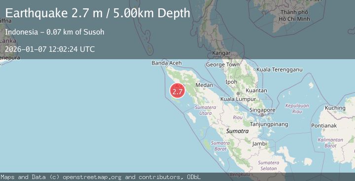
A 2.7 magnitude earthquake struck on NORTHERN SUMATRA, INDONESIA, at Wed, 07 Jan 2026 12:02:24 GMT. Depth: 5km. Reviewed by BMKG seismologists, this minor quake occurred at a magnitude type of m.
Magnitude
2.7
m
Source
BMKG
Intensity
-
Agency Reports
1 Sources| Source | Magnitude | Depth | Time |
|---|---|---|---|
| BMKGPrimary | 2.7 | 5 km | 1 month ago |
Earthquake Details
AutomaticEvent IDemsc_BMKG_20260107_0000199
Tsunami PotentialNo
Magnitude Typem
Nearest Places
- 40.2 km
- 41.3 km
- 41.8 km
- 42.4 km
- 42.7 km
Comments
Join the discussion about this event.
Latest Earthquakes
3.3Mag
Antofagasta, Chile
Time4 hours ago
Depth0.00 km
SourceVYT (Automatic)
2.0Mag
northern Sumatra, Indonesia
Time4 hours ago
Depth0.00 km
SourceVYT (Automatic)
3.8Mag
Fox Islands, Aleutian Islands, Alaska
Time4 hours ago
Depth24.41 km
SourceVYT (Automatic)
2.4Mag
Seram, Indonesia
Time4 hours ago
Depth10.13 km
SourceBMKG
1.8Mag
53 km ESE of Naalehu, Hawaii
Time4 hours ago
Depth18.79 km
SourceUSGS (Automatic)
Nearby Earthquakes
3.0Mag
NORTHERN SUMATRA, INDONESIA
Time5 years ago
Depth10.00 km
SourceDJA (Automatic)
2.0Mag
northern Sumatra, Indonesia
Time4 hours ago
Depth0.00 km
SourceVYT (Automatic)
2.5Mag
Northern Sumatra, Indonesia
Time1 month ago
Depth10.00 km
SourceBMKG (Automatic)
5.5Mag
NORTHERN SUMATRA, INDONESIA
Time20 years ago
Depth30.00 km
SourceEMSC (Automatic)
4.0Mag
NORTHERN SUMATRA, INDONESIA
Time4 months ago
Depth25.00 km
SourceBMKG (Automatic)