Earthquake MAKASSAR STRAIT, INDONESIA
Wed, 07 Jan 2026 19:51:58 GMT
Time1 month ago
Location
-3.4700, 117.1400
Depth
21.0 KM
Event Summary
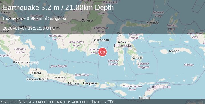
A 3.2 magnitude earthquake struck on MAKASSAR STRAIT, INDONESIA, at Wed, 07 Jan 2026 19:51:58 GMT. Depth: 21km. Reviewed by BMKG seismologists, this minor quake occurred at a magnitude type of m.
Magnitude
3.2
m
Source
BMKG
Intensity
-
Agency Reports
1 Sources| Source | Magnitude | Depth | Time |
|---|---|---|---|
| BMKGPrimary | 3.2 | 21 km | 1 month ago |
Earthquake Details
AutomaticEvent IDemsc_BMKG_20260107_0000339
Tsunami PotentialNo
Magnitude Typem
Nearest Places
- 36.6 km
- 63.8 km
- 75.6 km
- 76.2 km
- 78.6 km
Comments
Join the discussion about this event.
Latest Earthquakes
2.9Mag
Near North Coast of West Papua
Time3 hours ago
Depth9.19 km
SourceBMKG
1.9Mag
Southern Alaska
Time4 hours ago
Depth30.15 km
SourceVYT (Automatic)
2.1Mag
ISLAND OF HAWAII, HAWAII
Time4 hours ago
Depth9.10 km
SourceHV (Automatic)
1.7Mag
4 km WSW of San Juan Bautista, CA
Time4 hours ago
Depth4.65 km
SourceUSGS (Automatic)
3.0Mag
Borneo
Time4 hours ago
Depth5.85 km
SourceBMKG
Nearby Earthquakes
3.4Mag
KALIMANTAN, INDONESIA
Time3 weeks ago
Depth5.00 km
SourceBMKG (Automatic)
5.7Mag
SULAWESI, INDONESIA
Time18 years ago
Depth49.00 km
SourceEMSC (Automatic)
3.1Mag
KALIMANTAN, INDONESIA
Time1 month ago
Depth3.00 km
SourceBMKG (Automatic)
5.0Mag
SULAWESI, INDONESIA
Time15 years ago
Depth40.00 km
SourceEMSC (Automatic)
5.8Mag
SULAWESI, INDONESIA
Time3 years ago
Depth40.00 km
SourceEMSC (Automatic)