Earthquake NEAR N COAST OF PAPUA, INDONESIA
Fri, 09 Jan 2026 03:17:23 GMT
Time1 month ago
Location
-1.5800, 138.9100
Depth
10.0 KM
Event Summary
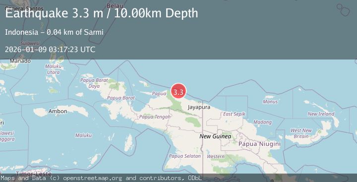
A 3.3 magnitude earthquake struck on NEAR N COAST OF PAPUA, INDONESIA, at Fri, 09 Jan 2026 03:17:23 GMT. Depth: 10km. Reviewed by BMKG seismologists, this minor quake occurred at a magnitude type of m.
Magnitude
3.3
m
Source
BMKG
Intensity
-
Agency Reports
1 Sources| Source | Magnitude | Depth | Time |
|---|---|---|---|
| BMKGPrimary | 3.3 | 10 km | 1 month ago |
Earthquake Details
AutomaticEvent IDemsc_BMKG_20260109_0000043
Tsunami PotentialNo
Magnitude Typem
Nearest Places
- Kampung Armo16.6 km
- Pulau Armo17.2 km
- Pulau Lamsutu18.0 km
- Pulau-pulau Kumamba18.8 km
- Kampung Liki20.5 km
Comments
Join the discussion about this event.
Latest Earthquakes
2.2Mag
Northern Sumatra, Indonesia
Time8 hours ago
Depth8.25 km
SourceBMKG
2.5Mag
Tarapaca, Chile
Time9 hours ago
Depth112.55 km
SourceVYT (Automatic)
2.0Mag
ALBANIA
Time9 hours ago
Depth15.00 km
SourceIGEO (Automatic)
2.3Mag
CENTRAL TURKEY
Time9 hours ago
Depth6.20 km
SourceAFAD (Automatic)
2.2Mag
Tarapaca, Chile
Time9 hours ago
Depth111.94 km
SourceVYT (Automatic)
Nearby Earthquakes
3.0Mag
Near North Coast of West Papua
Time1 week ago
Depth22.05 km
SourceBMKG
4.0Mag
NEAR N COAST OF PAPUA, INDONESIA
Time2 years ago
Depth10.00 km
SourceDJA (Automatic)
4.0Mag
NEAR N COAST OF PAPUA, INDONESIA
Time5 years ago
Depth10.00 km
SourceDJA (Automatic)
4.0Mag
NEAR N COAST OF PAPUA, INDONESIA
Time6 months ago
Depth14.00 km
SourceBMKG (Automatic)
2.8Mag
NEAR N COAST OF PAPUA, INDONESIA
Time1 month ago
Depth10.00 km
SourceBMKG (Automatic)