Earthquake SOUTH OF BALI, INDONESIA
Fri, 09 Jan 2026 03:41:08 GMT
Time1 month ago
Location
-9.6500, 114.1700
Depth
47.0 KM
Event Summary
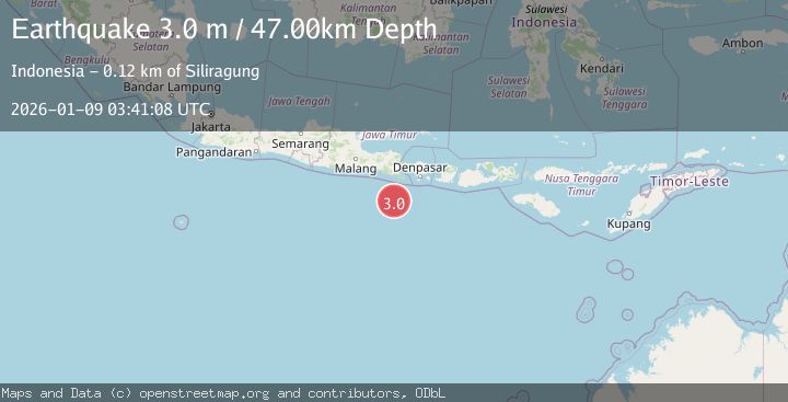
A 3.0 magnitude earthquake struck on SOUTH OF BALI, INDONESIA, at Fri, 09 Jan 2026 03:41:08 GMT. Depth: 47km. Reviewed by BMKG seismologists, this minor quake occurred at a magnitude type of m.
Magnitude
3.0
m
Source
BMKG
Intensity
-
Agency Reports
1 Sources| Source | Magnitude | Depth | Time |
|---|---|---|---|
| BMKGPrimary | 3.0 | 47 km | 1 month ago |
Earthquake Details
AutomaticEvent IDemsc_BMKG_20260109_0000052
Tsunami PotentialNo
Magnitude Typem
Nearest Places
- 98.4 km
- 100.6 km
- 102.6 km
- 102.6 km
- 102.6 km
Comments
Join the discussion about this event.
Latest Earthquakes
3.0Mag
Gulf of Alaska
Time8 minutes ago
Depth140.50 km
SourceVYT (Automatic)
3.7Mag
Timor Region
Time8 minutes ago
Depth16.48 km
SourceBMKG
4.0Mag
Solomon Islands
Time9 minutes ago
Depth112.55 km
SourceVYT (Automatic)
2.9Mag
Sumba region, Indonesia
Time10 minutes ago
Depth55.18 km
SourceVYT (Automatic)
3.0Mag
WESTERN TURKEY
Time11 minutes ago
Depth9.90 km
SourceKOERI (Automatic)
Nearby Earthquakes
2.7Mag
South of Bali, Indonesia
Time2 weeks ago
Depth10.00 km
SourceBMKG (Automatic)
4.0Mag
SOUTH OF BALI, INDONESIA
Time2 years ago
Depth10.00 km
SourceBMKG (Automatic)
3.0Mag
SOUTH OF BALI, INDONESIA
Time4 years ago
Depth10.00 km
SourceDJA (Automatic)
3.0Mag
SOUTH OF BALI, INDONESIA
Time4 years ago
Depth10.00 km
SourceDJA (Automatic)
2.7Mag
South of Bali, Indonesia
Time2 days ago
Depth8.65 km
SourceBMKG