Earthquake NEAR N COAST OF PAPUA, INDONESIA
Fri, 09 Jan 2026 22:59:46 GMT
Time1 month ago
Location
-0.9700, 134.3700
Depth
10.0 KM
Event Summary
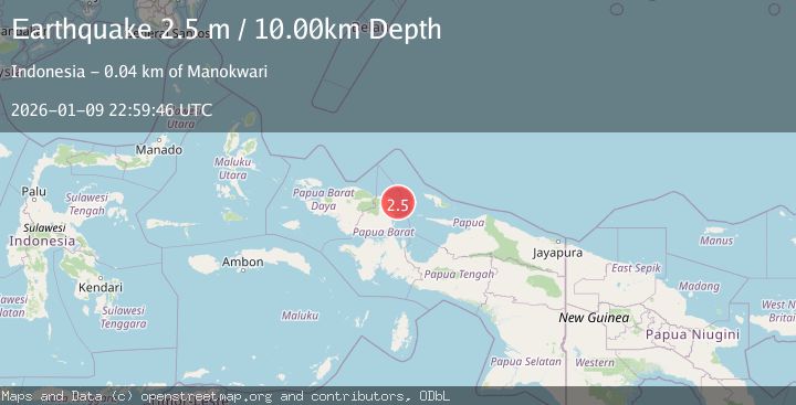
A 2.5 magnitude earthquake struck on NEAR N COAST OF PAPUA, INDONESIA, at Fri, 09 Jan 2026 22:59:46 GMT. Depth: 10km. Reviewed by BMKG seismologists, this minor quake occurred at a magnitude type of m.
Magnitude
2.5
m
Source
BMKG
Intensity
-
Agency Reports
1 Sources| Source | Magnitude | Depth | Time |
|---|---|---|---|
| BMKGPrimary | 2.5 | 10 km | 1 month ago |
Earthquake Details
AutomaticEvent IDemsc_BMKG_20260109_0000340
Tsunami PotentialNo
Magnitude Typem
Nearest Places
- Tanjung Memori28.3 km
- Kampung Bakaro28.7 km
- Kampung Arowi29.4 km
- Pulau Mansman29.8 km
- Saomis29.9 km
Comments
Join the discussion about this event.
Latest Earthquakes
3.0Mag
Java, Indonesia
Time2 minutes ago
Depth29.78 km
SourceBMKG
2.4Mag
Finland-Russia border region
Time3 minutes ago
Depth341.92 km
SourceVYT (Automatic)
0.9Mag
8 km W of Cobb, CA
Time8 minutes ago
Depth1.53 km
SourceUSGS (Automatic)
1.8Mag
Central Alaska
Time11 minutes ago
Depth2.08 km
SourceVYT (Automatic)
2.9Mag
WESTERN TURKEY
Time14 minutes ago
Depth11.80 km
SourceKOERI (Automatic)
Nearby Earthquakes
3.4Mag
West Papua Region, Indonesia
Time3 weeks ago
Depth10.00 km
SourceBMKG (Automatic)
2.4Mag
West Papua Region, Indonesia
Time1 week ago
Depth20.30 km
SourceBMKG (Automatic)
4.0Mag
NEAR N COAST OF PAPUA, INDONESIA
Time4 years ago
Depth12.00 km
SourceDJA (Automatic)
2.8Mag
West Papua Region, Indonesia
Time3 weeks ago
Depth10.00 km
SourceBMKG (Automatic)
2.0Mag
West Papua Region, Indonesia
Time5 days ago
Depth13.59 km
SourceBMKG