Earthquake MOLUCCA SEA
Mon, 12 Jan 2026 12:13:58 GMT
Time1 month ago
Location
-0.1000, 124.7500
Depth
12.0 KM
Event Summary
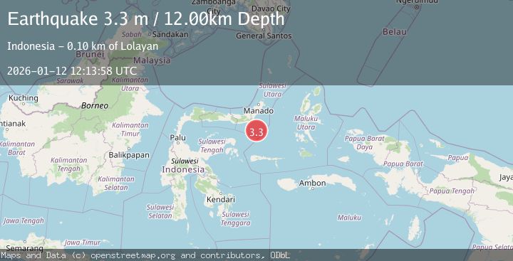
A 3.3 magnitude earthquake struck on MOLUCCA SEA, at Mon, 12 Jan 2026 12:13:58 GMT. Depth: 12km. Reviewed by BMKG seismologists, this minor quake occurred at a magnitude type of m.
Magnitude
3.3
m
Source
BMKG
Intensity
-
Agency Reports
1 Sources| Source | Magnitude | Depth | Time |
|---|---|---|---|
| BMKGPrimary | 3.3 | 12 km | 1 month ago |
Earthquake Details
AutomaticEvent IDemsc_BMKG_20260112_0000176
Tsunami PotentialNo
Magnitude Typem
Nearest Places
- Pulau Lampu68.0 km
- Batu Mandi68.1 km
- Tanjung Payunga69.0 km
- Tanjung Flesko69.0 km
- Libuton Babi69.2 km
Comments
Join the discussion about this event.
Latest Earthquakes
2.5Mag
Bering Strait
Time1 hour ago
Depth200.07 km
SourceVYT (Automatic)
2.3Mag
Sumbawa Region, Indonesia
Time1 hour ago
Depth10.00 km
SourceBMKG
1.6Mag
13 km ENE of Falls City, Texas
Time1 hour ago
Depth7.18 km
SourceUSGS (Automatic)
1.5Mag
EASTERN TURKEY
Time1 hour ago
Depth7.00 km
SourceAFAD (Automatic)
1.3Mag
5 km S of Cabazon, CA
Time1 hour ago
Depth5.80 km
SourceUSGS (Automatic)
Nearby Earthquakes
4.0Mag
MOLUCCA SEA
Time5 years ago
Depth29.00 km
SourceDJA (Automatic)
3.5Mag
Southern Molucca Sea
Time2 weeks ago
Depth11.57 km
SourceBMKG (Automatic)
5.0Mag
MOLUCCA SEA
Time19 years ago
Depth60.00 km
SourceEMSC (Automatic)
5.0Mag
MOLUCCA SEA
Time6 years ago
Depth74.00 km
SourceEMSC (Automatic)
4.0Mag
MOLUCCA SEA
Time1 year ago
Depth10.00 km
SourceBMKG (Automatic)