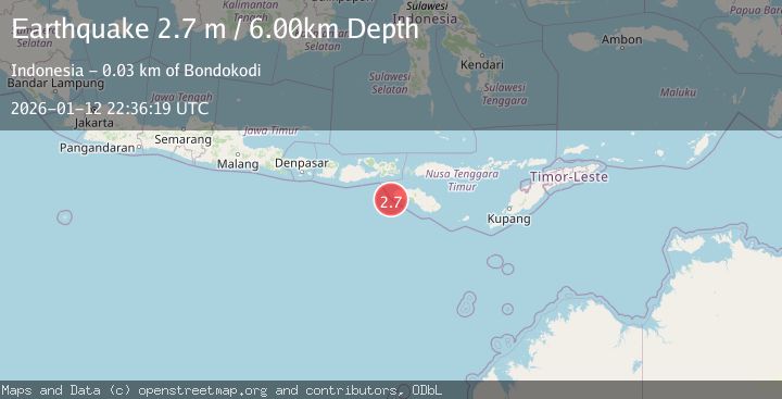
Earthquake SUMBAWA REGION, INDONESIA
Mon, 12 Jan 2026 22:36:19 GMT
Time1 month ago
Location
-9.7800, 118.8400
Depth
6.0 KM
Event Summary
A 2.7 magnitude earthquake struck on SUMBAWA REGION, INDONESIA, at Mon, 12 Jan 2026 22:36:19 GMT. Depth: 6km. Reviewed by BMKG seismologists, this minor quake occurred at a magnitude type of m.
Magnitude
2.7
m
Source
BMKG
Intensity
-
Agency Reports
1 Sources| Source | Magnitude | Depth | Time |
|---|---|---|---|
| BMKGPrimary | 2.7 | 6 km | 1 month ago |
Earthquake Details
AutomaticEvent IDemsc_BMKG_20260112_0000344
Tsunami PotentialNo
Magnitude Typem
Nearest Places
- Tanjung Waibuku23.6 km
- Tanjung Mbulir23.6 km
- Waibuku23.8 km
- Mbulir23.9 km
- Galukalowo24.0 km
Comments
Join the discussion about this event.
Latest Earthquakes
2.0Mag
Antofagasta, Chile
Time23 hours ago
Depth133.54 km
SourceVYT (Automatic)
1.5Mag
California-Baja California border region
Time23 hours ago
Depth16.24 km
SourceVYT (Automatic)
1.1Mag
6 km NW of The Geysers, CA
Time23 hours ago
Depth1.72 km
SourceUSGS (Automatic)
1.8Mag
Central Alaska
Time23 hours ago
Depth0.00 km
SourceVYT (Automatic)
1.7Mag
Southeastern Alaska
Time23 hours ago
Depth11.84 km
SourceVYT (Automatic)
Nearby Earthquakes
2.5Mag
Sumbawa Region, Indonesia
Time3 weeks ago
Depth0.00 km
SourceBMKG (Automatic)
4.0Mag
SUMBAWA REGION, INDONESIA
Time7 years ago
Depth10.00 km
SourceDJA (Automatic)
3.5Mag
SUMBAWA REGION, INDONESIA
Time1 month ago
Depth29.00 km
SourceBMKG (Automatic)
3.0Mag
SUMBAWA REGION, INDONESIA
Time3 years ago
Depth10.00 km
SourceDJA (Automatic)
2.4Mag
Sumbawa Region, Indonesia
Time3 weeks ago
Depth10.00 km
SourceBMKG (Automatic)