Earthquake TIMOR REGION, INDONESIA
Tue, 13 Jan 2026 02:09:12 GMT
Time1 month ago
Location
-10.0800, 123.8400
Depth
59.0 KM
Event Summary
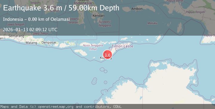
A 3.6 magnitude earthquake struck on TIMOR REGION, INDONESIA, at Tue, 13 Jan 2026 02:09:12 GMT. Depth: 59km. Reviewed by BMKG seismologists, this minor quake occurred at a magnitude type of m.
Magnitude
3.6
m
Source
BMKG
Intensity
-
Agency Reports
1 Sources| Source | Magnitude | Depth | Time |
|---|---|---|---|
| BMKGPrimary | 3.6 | 29 km | 1 month ago |
Earthquake Details
AutomaticEvent IDemsc_BMKG_20260113_0000034
Tsunami PotentialNo
Magnitude Typem
Nearest Places
- Noel Pulukayu0.4 km
- Kampungbaru0.5 km
- Kelurahan Naibonat1.1 km
- Noel Airkom1.7 km
- Pulukayu1.9 km
Comments
Join the discussion about this event.
Latest Earthquakes
2.8Mag
West Papua Region, Indonesia
Time8 minutes ago
Depth34.12 km
SourceBMKG
3.6Mag
NORTHERN ALGERIA
Time15 minutes ago
Depth5.80 km
SourceIGN (Automatic)
2.6Mag
Java, Indonesia
Time18 minutes ago
Depth214.22 km
SourceBMKG
1.0Mag
Southeastern Alaska
Time18 minutes ago
Depth0.00 km
SourceVYT (Automatic)
3.5Mag
COOK STRAIT, NEW ZEALAND
Time19 minutes ago
Depth75.30 km
SourceGNS (Automatic)
Nearby Earthquakes
5.8Mag
TIMOR REGION, INDONESIA
Time12 years ago
Depth45.00 km
SourceEMSC (Automatic)
4.0Mag
TIMOR REGION, INDONESIA
Time5 years ago
Depth21.00 km
SourceDJA (Automatic)
6.0Mag
TIMOR REGION, INDONESIA
Time2 years ago
Depth39.00 km
SourceEMSC (Automatic)
3.0Mag
TIMOR REGION, INDONESIA
Time1 year ago
Depth91.00 km
SourceBMKG (Automatic)
3.0Mag
TIMOR REGION, INDONESIA
Time2 years ago
Depth79.00 km
SourceBMKG (Automatic)