Earthquake NEAR N COAST OF PAPUA, INDONESIA
Wed, 14 Jan 2026 03:20:52 GMT
Time1 month ago
Location
-2.9000, 135.6400
Depth
10.0 KM
Event Summary
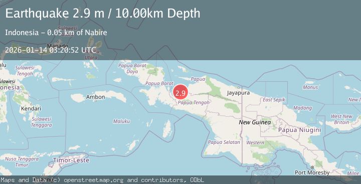
A 2.9 magnitude earthquake struck on NEAR N COAST OF PAPUA, INDONESIA, at Wed, 14 Jan 2026 03:20:52 GMT. Depth: 10km. Reviewed by BMKG seismologists, this minor quake occurred at a magnitude type of m.
Magnitude
2.9
m
Source
BMKG
Intensity
-
Agency Reports
1 Sources| Source | Magnitude | Depth | Time |
|---|---|---|---|
| BMKGPrimary | 2.9 | 10 km | 1 month ago |
Earthquake Details
AutomaticEvent IDemsc_BMKG_20260114_0000039
Tsunami PotentialNo
Magnitude Typem
Nearest Places
- Kampung Kama6.9 km
- Pulau Nutorutomorya7.8 km
- Moor8.0 km
- Kampung Moor9.2 km
- Pulau-pulau Moor10.0 km
Comments
Join the discussion about this event.
Latest Earthquakes
2.5Mag
Java, Indonesia
Time1 hour ago
Depth76.49 km
SourceBMKG
1.9Mag
Tarapaca, Chile
Time1 hour ago
Depth7.93 km
SourceVYT (Automatic)
2.4Mag
West Papua Region, Indonesia
Time1 hour ago
Depth10.00 km
SourceBMKG
2.7Mag
Antofagasta, Chile
Time1 hour ago
Depth0.00 km
SourceVYT (Automatic)
2.7Mag
Tarapaca, Chile
Time1 hour ago
Depth10.50 km
SourceVYT (Automatic)
Nearby Earthquakes
2.7Mag
West Papua Region, Indonesia
Time2 weeks ago
Depth10.00 km
SourceBMKG (Automatic)
3.0Mag
NEAR N COAST OF PAPUA, INDONESIA
Time10 months ago
Depth10.00 km
SourceBMKG (Automatic)
5.1Mag
PAPUA, INDONESIA
Time5 years ago
Depth10.00 km
SourceEMSC (Automatic)
3.0Mag
NEAR N COAST OF PAPUA, INDONESIA
Time2 years ago
Depth10.00 km
SourceBMKG (Automatic)
3.0Mag
PAPUA, INDONESIA
Time2 years ago
Depth10.00 km
SourceBMKG (Automatic)