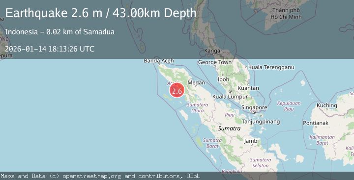
Earthquake NORTHERN SUMATRA, INDONESIA
Wed, 14 Jan 2026 18:13:26 GMT
Time1 month ago
Location
3.2700, 96.9600
Depth
43.0 KM
Event Summary
A 2.6 magnitude earthquake struck on NORTHERN SUMATRA, INDONESIA, at Wed, 14 Jan 2026 18:13:26 GMT. Depth: 43km. Reviewed by BMKG seismologists, this minor quake occurred at a magnitude type of m.
Magnitude
2.6
m
Source
BMKG
Intensity
-
Agency Reports
1 Sources| Source | Magnitude | Depth | Time |
|---|---|---|---|
| BMKGPrimary | 2.6 | 43 km | 1 month ago |
Earthquake Details
AutomaticEvent IDemsc_BMKG_20260114_0000253
Tsunami PotentialNo
Magnitude Typem
Nearest Places
- Batu Berlayar16.6 km
- Aluepaku18.6 km
- Alue Tgk Glee19.5 km
- Ujung Karang19.6 km
- Gunung Cut19.6 km
Comments
Join the discussion about this event.
Latest Earthquakes
3.2Mag
Antofagasta, Chile
Time9 minutes ago
Depth124.27 km
SourceVYT (Automatic)
1.7Mag
Kenai Peninsula, Alaska
Time15 minutes ago
Depth28.44 km
SourceVYT (Automatic)
1.7Mag
Tarapaca, Chile
Time18 minutes ago
Depth6.47 km
SourceVYT (Automatic)
1.9Mag
Central Alaska
Time21 minutes ago
Depth81.18 km
SourceVYT (Automatic)
1.2Mag
21 km ENE of Little Lake, CA
Time22 minutes ago
Depth0.90 km
SourceUSGS (Automatic)
Nearby Earthquakes
3.0Mag
NORTHERN SUMATRA, INDONESIA
Time8 months ago
Depth17.00 km
SourceBMKG (Automatic)
2.0Mag
Northern Sumatra, Indonesia
Time1 week ago
Depth10.50 km
SourceBMKG (Automatic)
5.8Mag
NORTHERN SUMATRA, INDONESIA
Time1 year ago
Depth54.00 km
SourceEMSC (Automatic)
4.0Mag
NORTHERN SUMATRA, INDONESIA
Time5 years ago
Depth30.00 km
SourceDJA (Automatic)
5.1Mag
NORTHERN SUMATRA, INDONESIA
Time20 years ago
Depth60.00 km
SourceEMSC (Automatic)