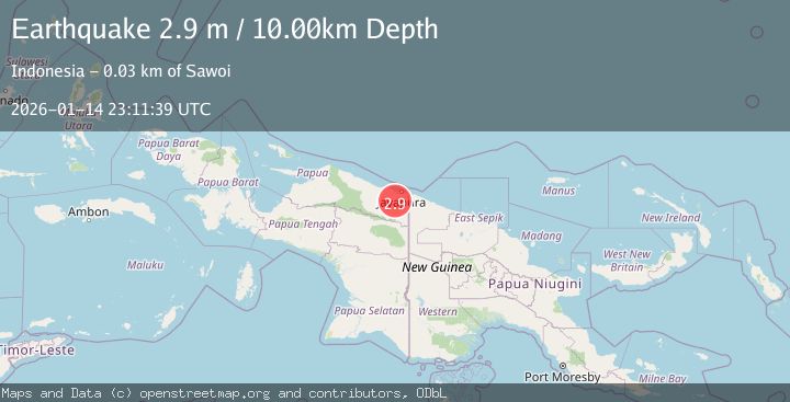
Earthquake NEAR N COAST OF PAPUA, INDONESIA
Wed, 14 Jan 2026 23:11:39 GMT
Time1 month ago
Location
-2.9000, 140.4500
Depth
10.0 KM
Event Summary
A 2.9 magnitude earthquake struck on NEAR N COAST OF PAPUA, INDONESIA, at Wed, 14 Jan 2026 23:11:39 GMT. Depth: 10km. Reviewed by BMKG seismologists, this minor quake occurred at a magnitude type of m.
Magnitude
2.9
m
Source
BMKG
Intensity
-
Agency Reports
1 Sources| Source | Magnitude | Depth | Time |
|---|---|---|---|
| BMKGPrimary | 2.9 | 10 km | 1 month ago |
Earthquake Details
AutomaticEvent IDemsc_BMKG_20260114_0000329
Tsunami PotentialNo
Magnitude Typem
Nearest Places
- Kampung Skanto3.9 km
- Distrik Skanto8.9 km
- Samsi15.8 km
- Kampung Gudang Garam16.1 km
- Gunung Nimboran16.6 km
Comments
Join the discussion about this event.
Latest Earthquakes
1.9Mag
western Texas
Time3 minutes ago
Depth0.24 km
SourceVYT (Automatic)
2.2Mag
western Texas
Time5 minutes ago
Depth0.24 km
SourceVYT (Automatic)
2.2Mag
Valparaiso, Chile
Time7 minutes ago
Depth22.83 km
SourceVYT (Automatic)
4.5Mag
Central Alaska
Time8 minutes ago
Depth7.81 km
SourceVYT (Automatic)
1.9Mag
1 km SSW of Pāhala, Hawaii
Time11 minutes ago
Depth28.47 km
SourceUSGS (Automatic)
Nearby Earthquakes
2.4Mag
Near North Coast of West Papua
Time6 days ago
Depth40.34 km
SourceBMKG
2.8Mag
Near North Coast of West Papua
Time3 days ago
Depth10.00 km
SourceBMKG
3.0Mag
Near North Coast of West Papua
Time3 days ago
Depth9.06 km
SourceBMKG
3.0Mag
NEAR N COAST OF PAPUA, INDONESIA
Time5 years ago
Depth10.00 km
SourceDJA (Automatic)
4.0Mag
NEAR N COAST OF PAPUA, INDONESIA
Time6 years ago
Depth23.00 km
SourceDJA (Automatic)