Earthquake SOUTH OF SUMBAWA, INDONESIA
Thu, 15 Jan 2026 22:27:40 GMT
Time1 month ago
Location
-10.2300, 118.7800
Depth
10.0 KM
Event Summary
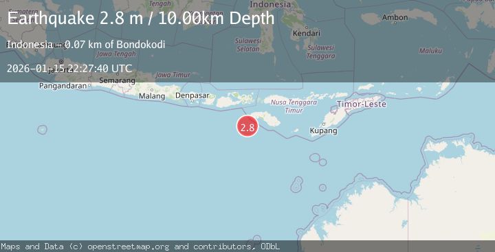
A 2.8 magnitude earthquake struck on SOUTH OF SUMBAWA, INDONESIA, at Thu, 15 Jan 2026 22:27:40 GMT. Depth: 10km. Reviewed by BMKG seismologists, this minor quake occurred at a magnitude type of m.
Magnitude
2.8
m
Source
BMKG
Intensity
-
Agency Reports
1 Sources| Source | Magnitude | Depth | Time |
|---|---|---|---|
| BMKGPrimary | 2.8 | 10 km | 1 month ago |
Earthquake Details
AutomaticEvent IDemsc_BMKG_20260115_0000335
Tsunami PotentialNo
Magnitude Typem
Nearest Places
- Tanjung Waikataku66.5 km
- Tanjung Mareha66.6 km
- Loko Waikataku66.7 km
- Pulau Malondobara67.0 km
- Pulau Barenggemonokodi67.0 km
Comments
Join the discussion about this event.
Latest Earthquakes
2.4Mag
Fox Islands, Aleutian Islands, Alaska
Time10 hours ago
Depth1.22 km
SourceVYT (Automatic)
2.8Mag
Flores region, Indonesia
Time10 hours ago
Depth190.67 km
SourceVYT (Automatic)
2.8Mag
Poland
Time11 hours ago
Depth10.50 km
SourceVYT (Automatic)
1.3Mag
CENTRAL TURKEY
Time11 hours ago
Depth7.00 km
SourceAFAD (Automatic)
2.1Mag
Northern Sumatra, Indonesia
Time11 hours ago
Depth65.56 km
SourceBMKG
Nearby Earthquakes
2.5Mag
SOUTH OF SUMBAWA, INDONESIA
Time1 month ago
Depth98.00 km
SourceBMKG (Automatic)
2.6Mag
SOUTH OF SUMBAWA, INDONESIA
Time1 month ago
Depth14.00 km
SourceBMKG (Automatic)
3.0Mag
SOUTH OF SUMBAWA, INDONESIA
Time2 months ago
Depth10.00 km
SourceBMKG (Automatic)
5.0Mag
SOUTH OF SUMBAWA, INDONESIA
Time2 years ago
Depth45.00 km
SourceEMSC (Automatic)
3.0Mag
SOUTH OF SUMBAWA, INDONESIA
Time5 months ago
Depth10.00 km
SourceBMKG (Automatic)